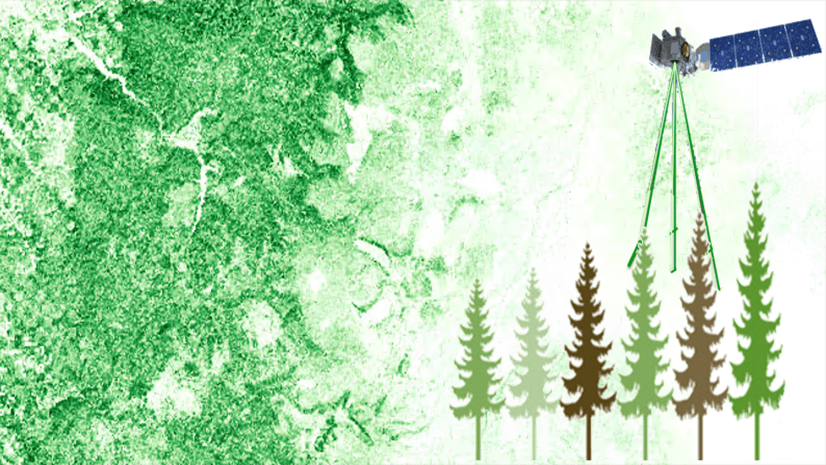
NASA’s latest earth space mission, EMIT (Earth Surface Mineral Dust Source Investigation), collects hyperspectral imagery to map dust sources, aiming for a better understanding of their impacts on climate.
EMIT hyperspectral imagery contains 285 bands spanning wavelengths from 380 to 2500 nanometers. Its high spectral resolution, covering visible range to short wavelength range, enhances the discernment of minerals and vegetation types. Moreover, the mineral products generated by the EMIT mission facilitate global mineral understanding and mapping. To fully leverage these invaluable scientific products, we have integrated EMIT support in ArcGIS Pro 3.3. This blog article informs and provides a guide on using ArcGIS to explore EMIT hyperspectral imagery, conduct analyses, and generate mineral maps using the derived mineral products.
Explore EMIT hyperspectral imagery
The EMIT mission stores data using a netCDF file, which is a familiar format for multidimensional raster data; however, to incorporate EMIT data as a hyperspectral imagery in Pro 3.3, you must use the Make Raster Layer tool.

To enhance the image display, use DRA (Dynamic Range Adjustment) to dynamically calculate statistics and apply a Percent Clip stretch.
The high spectral resolution offers enhanced discernibility by combining bands within specific wavelength ranges. To enhance the user experience, we have enabled wavelength-based band selection. Simply adjust the red, green, and blue handles to the desired wavelength for optimal visualization.

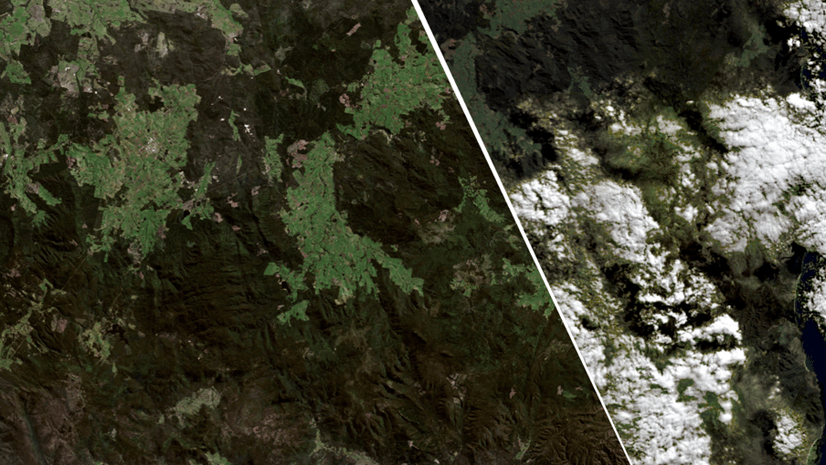
For instance, combining bands with wavelengths of 2271 nm, 1513 nm, and 745 nm reveals distinct features, effectively distinguishing between snow and clouds on the map.

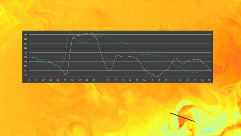
To further confirm these as two distinctive features, we can compare the spectral profiles at these two locations. They exhibit completely dissimilarity, particularly beyond the visible range.

Analyze using spectral indices
A quick and efficient method to extract information from your imagery is through spectra indices, which also applies to hyperspectral imagery. You can utilize the Indices tools or the Band Arithmetic function in ArcGIS Pro to generate diverse types of indices from the hyperspectral bands, including these related to vegetation, water, and geology. In this blog, I will demonstrate how to calculate a Kaolinitic index using this formula B2235:2365/B2145:2185, as referenced in this Index Database . I mapped the wavelength to EMIT’s band 251 and band 238 and created a raster layer using the Band Arithmetic function as shown below.


Work with EMIT mineral product
In addition to hyperspectral radiance and reflectance data, the EMIT mission also produces and distributes mineral products. The new EMIT raster type introduced in Pro 3.3 facilitates the management of these products. The level 2 mineral product consists of twelve extracted minerals represented as mineral IDs and their corresponding band depths, which serve as proxies for the mineral abundance. To generate a mineral map for a specific area, you can create a mosaic dataset, then populate it with data using the mineral ID template provided by the EMIT raster type.


Similarly, you can create a band depth mosaic dataset using the band depth template of EMIT raster type.

To obtain the mineral names and link them with the mosaic dataset, follow these steps:
- Access the mineral table from one of the images. Create a raster layer using the file path with a prefix and suffix. For example:
"EMITL2MIN:"D:\data\EMIT_L2B_MIN_001_20220829T165553_2224111_002.nc”: group_1_mineral_id. - This raster layer contains an attribute table, open the attribute table from the layer and save it.
- Access the Edit Mosaic Dataset Functions from the Mosaic Dataset Properties, then insert an Attribute Table function with this saved table into the mosaic dataset.
By following this process, you establish the link between mineral names and pixel values. Now, you can easily identify the mineral name and its associated band depth at any location within the dataset.

Map mineral heat sources
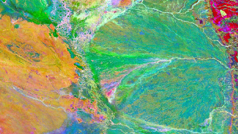
Based on research indicating that three minerals: hematite, goethite, and kaolinite are primary contributors to atmospheric warming, I extracted the band depths for the three minerals from both group 1 and group 2 minerals and composited an RGB image. The resulting map highlights the three major heat sources, with goethite is represented by red, hematite dominates in green, and kaolinite in blue.

EMIT’s level 3 product extracts 10 minerals at a coarse spatial resolution but provides a global coverage. The netCDF that stores this level 3 product adopts a multidimensional raster structure, which you can add it using the Multidimensional Raster option from the Add Data dropdown menu. For example, here I added the hematite variable.

After overlapping the mineral map with the country boundaries, I calculated the areas of the mineral source per country and discovered that minerals contributing heat sources are present in 67 countries. The top 10 countries are illustrated in the following chart, which China, Algeria, and Australia ranking as the top 3 in total areas.

Given that one pixel may contain a mixture of minerals, it’s important to refine the estimates. To achieve this, I incorporated the abundance data into the table. Interestingly, when considering the abundance of minerals, the ranking of their contribution to heating atmosphere rank differs from their ranking based solely on area.

This is a quick introduction to the enhancements on EMIT support in ArcGIS Pro 3.3. I hope the tips and steps provided can get your started on this new feature. While you may notice that classifying EMIT hyperspectral imagery capability is not included in this blog article due to length constraints, be assured that it is supported! I encourage you to stay tuned for the improvement in the user experience and analysis capabilities in the future.

I would love to have a tutorial for beginners on this topic! Also, where can we get the imagery?
Hello, I would like to know if these images require orthorectification. If they do, could you please assist me in finding a method to accomplish it? I have tried searching on platforms like YouTube, but I couldn’t find a suitable solution.