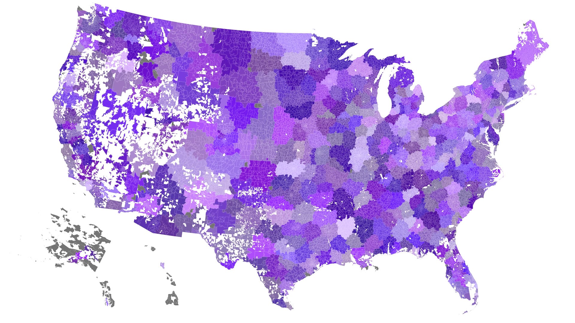
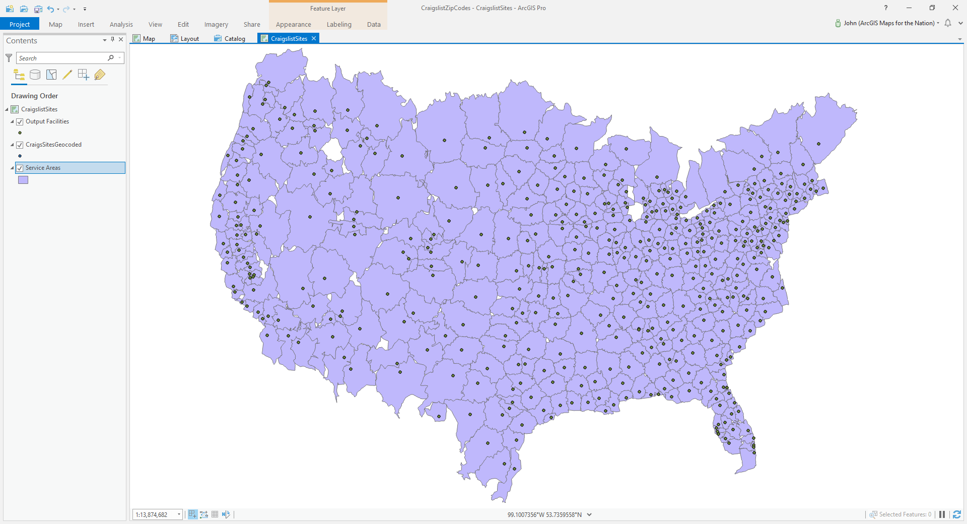
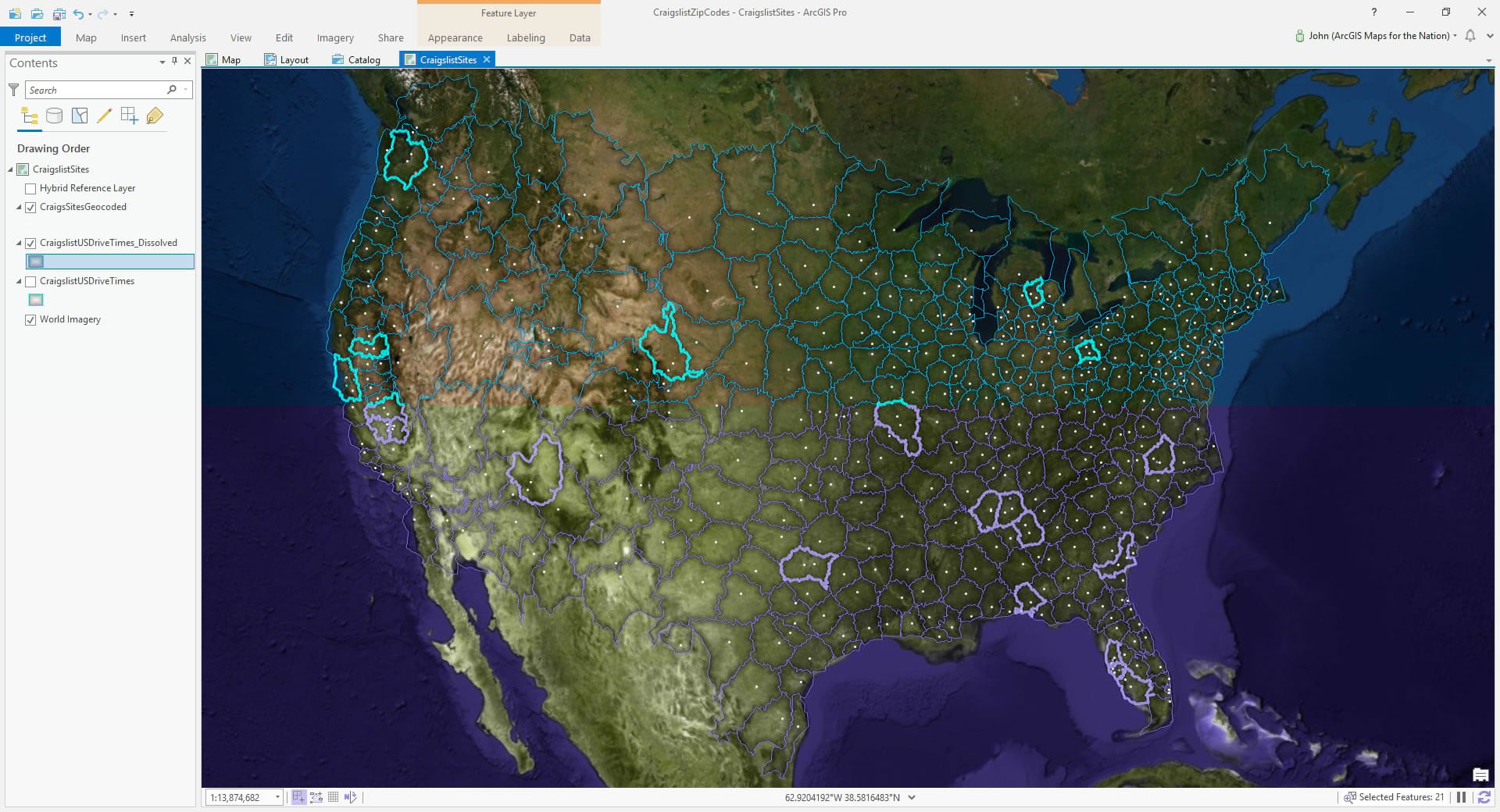
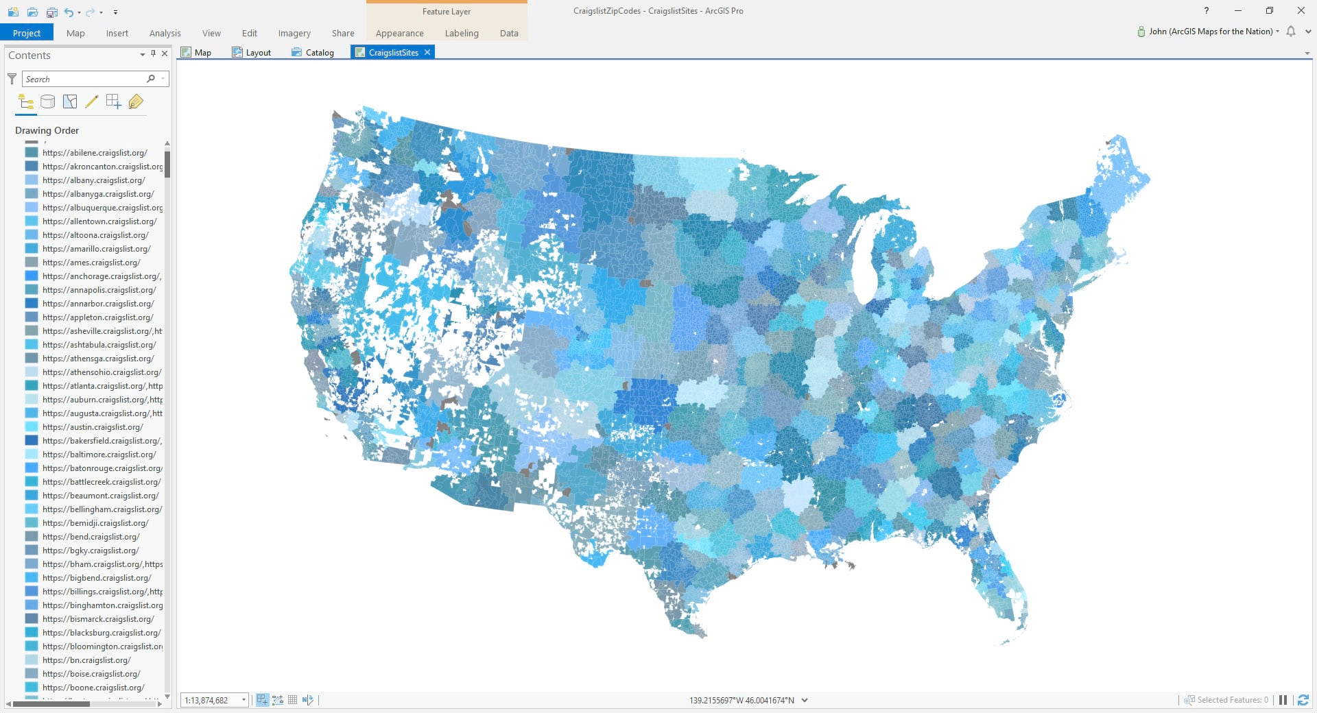
Here are Zip Code Tabulation Areas colored by what Craigslist economic zone they fall within.
If you’d like to just skip all the how-to-edness and grab the data I won’t hold it against you much.
- Craigslist economic zones derived from drive-time areas (24MB)
- Zip Code Tabulation Areas with Craigslist zone affiliation attribute (59MB).
- Simple Excel lookup table of Zip Codes to Craigslist zones (62KB).
This map does two things. It grows economic zones from Craigslist’s list of sites using Drive-Time. Then it associates member zip codes using a spatial join. Here’s how to do it…
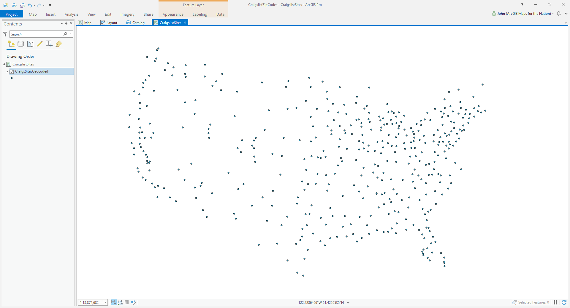
Site Names to Geographic Points
In the past I’ve zoned up the US into Craigslist states via a simple Thiessen (Vorornoi) method. That’s cool and everything, but not great. Craigslist transactions are a primarily a literal transportation network transaction. You buy a kayak, you go pick it up. No unseen delivery mechanism or virtual transaction. Craigslist involves getting in a car (or walking or public transit). So drive times are a great way to draw up these economic zones.
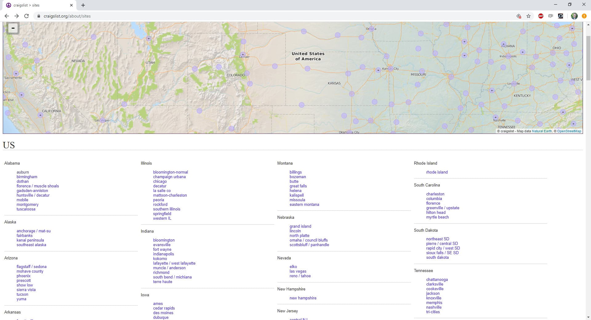
Craigslist provides a big list of all their sites, and a map that plots some of those locations. In some instances sites have a dual-location name (like Raleigh/Durham) and sometimes they have generic locations (like “Southeast Iowa”). Sometimes there are multiple points on the map that link to the same site. So I captured all these locations and did my best to manually place then geocode them. Here is an excel table of that if you like. Glorious glorious geographic points.
Geographic Points to Drive-Time Areas
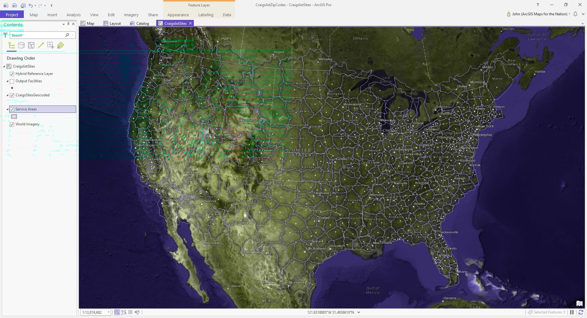
I used these points as the input locations for the “Generate Service Areas” tool. I left all the parameters the default with the exception of “Geometry at Overlaps” which I set to “Not Overlapping.” That way the areas plow into each other and stop, creating discrete zones weighted by the underlying street network.
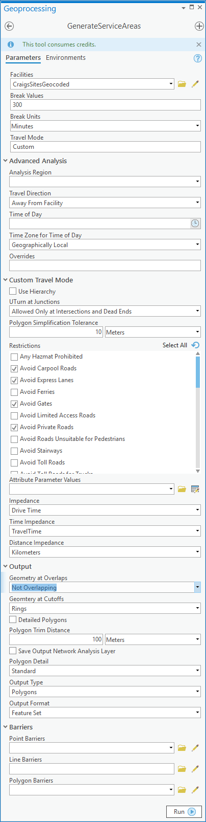
A note on credits. This tool “consumes” credits. Hang on a second here; “consumes” feels so hungry so rapacious. What if it said, “this tool requires loving feeding of credits”? Anyway, it costs one half credit per input location. With 442 input locations that’s 221 credits, which the credit doc page tells me is worth around $22.10. I mean, this is a lot of input locations. ¯\_(ツ)_/¯
I ran the tool and it took just under an hour. The process is done remotely since I’m using the esri road network, and the results catapulted right back to my laptop.
Here they are with some basemap context.
I could also clip away the resulting Craigslist economic zones that spill into Canada and Mexico (they have their own Craigslist sites, after all, and crossing a border can be a burden), but if someone in Northern Montana wants to cross the border to pick up a kayak who am I to get in the way? The zip code affiliation step a bit later on will largely mitigate this border concern anyway.
Remember how I sometimes made several geographic locations for Craigslist sites (or sometimes the Craigslist map plotted multiple points for a single site)? For example, I had drive-time input locations for both Raleigh and Durham for the “Raleigh / Durham / CH” craigslist site. And Akron and Canton points for the single “Akron / Canton” site. There’s lots of this sort of thing in my list.
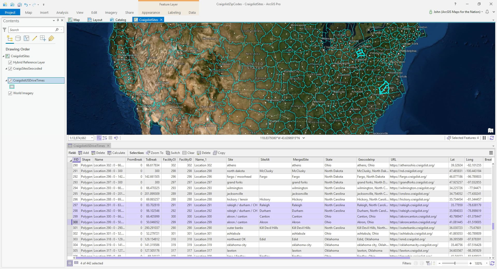
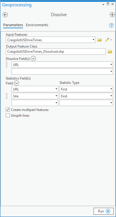
Time to dissolve these into their true singular entities by doing a Dissolve. I dissolved by their Craigslist site URL.
Here is a quick selection of some of the merged drive-time zones for multi-place sites, to give you an idea of what I mean…
You can have at these Craigslist economic zones (that’s an $22 value!). Lots of cool things to be done with these. Here is one cool thing you can do…
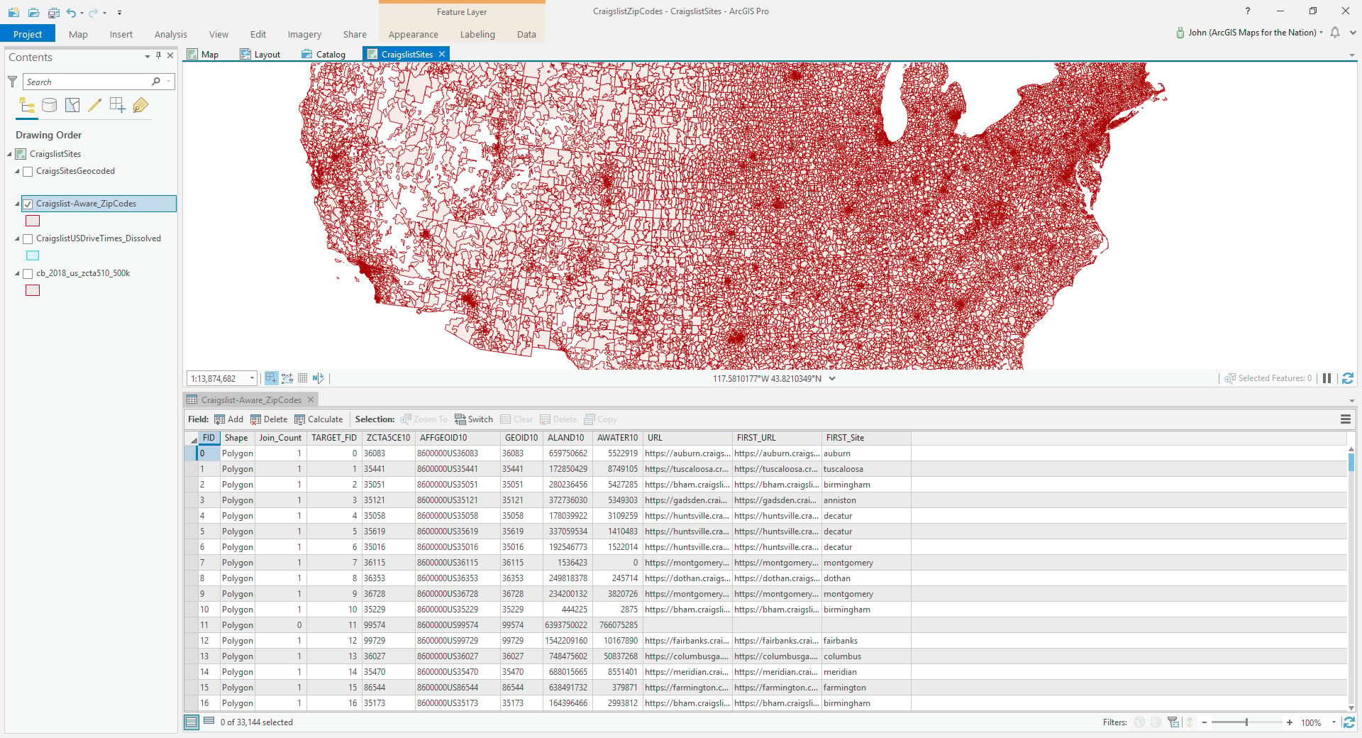
Assigning Zip Codes a Craigslist Affiliation
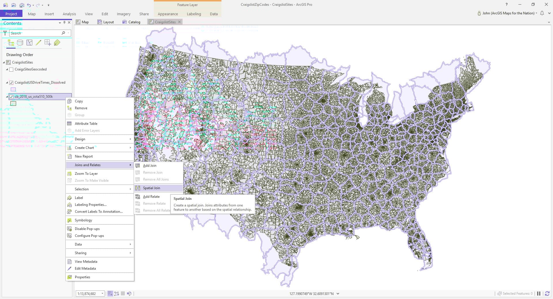
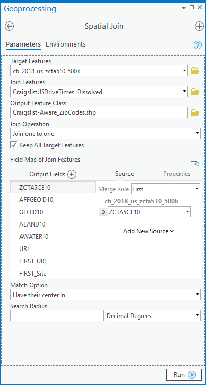
In the past when I’ve made the simpler versions of these Craigslist zones, I got requests for lists of zip codes that fell within each. That’s an intriguing idea and probably really useful as a marketing tool. It’s mega simple to do, using the just-plain-bonkers-magic of a spatial join.
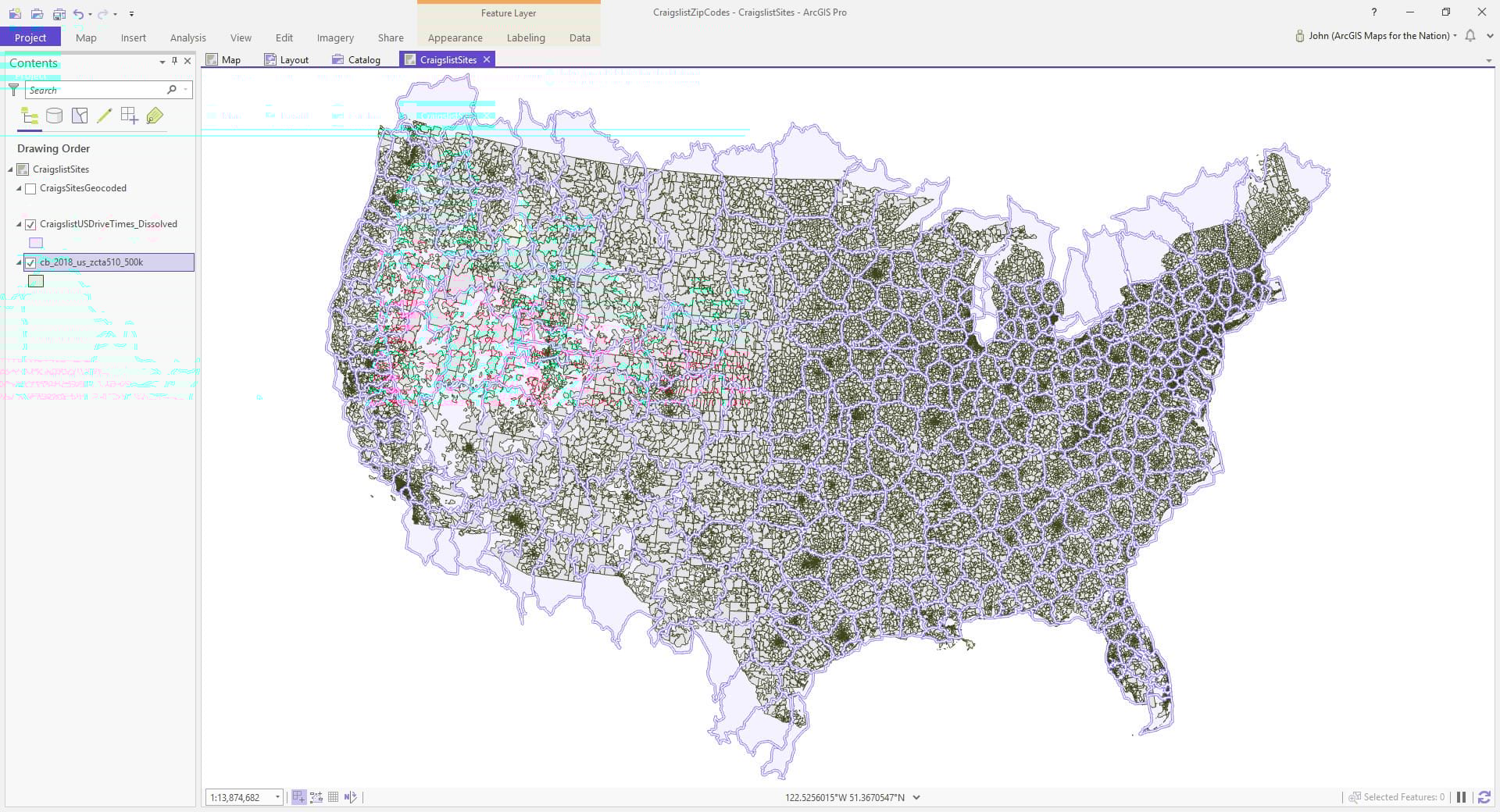
I downloaded a big fat shapefile of 2018 Zip Code Tabulation Areas from the benevolent and gracious US Census Bureau.
You can associate the attributes of features in one layer based on their proximity to features in another layer. Below is a one-minute video showing you how. What a time to be alive!
And here you can see the zip codes now have an attribute that says what Craigslist zone they fall within.
You can have this data (59MB shapefile), but please use your powers for good instead of evil.
If you’d rather not deal with the shapes of all these zip code areas, and prefer a lean (62KB) Excel lookup table of zip codes to Craigslist zones then you can download that here. If you are interested in adding demographic attributes to Craigslist zones, then check out this related post.
Thanks for following along, and all the best in your own drive-time-economic-zone-creating information-joining understanding-building action-enabling adventures! John

Commenting is not enabled for this article.