By Sem Keijsper and Nico Bos, Developers, Waternet – Banner image courtesy of Dennis Noordenbos.
In the Netherlands’ capital city of Amsterdam, at the shore of the Amstel resides a governmental organization called Waternet. It is the only company in the Netherlands responsible for the entire water cycle: rainwater drainage, wastewater treatment, and tap water production. Managing the water cycle can be challenging, which is why we use Esri’s ArcGIS software. This technology provides a system of record for geographical data and enables maps, applications, and solutions that empower our staff to work better.
A Legislative Challenge
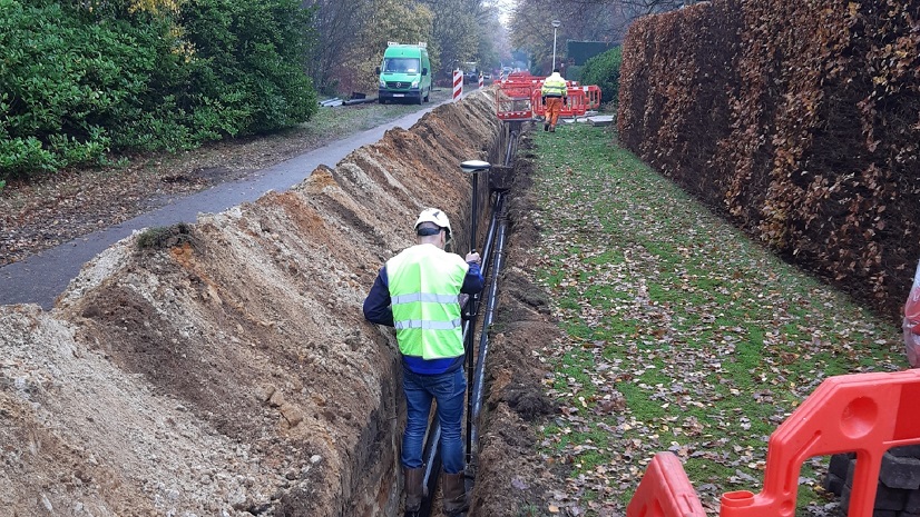
Dutch legislation requires every company in the Netherlands to register modifications to the underground infrastructure—mostly piping in our case—within 30 days. During the final handover stage, contractors provided revision drawings, which were then manually digitized to process these modifications. With 300 annual projects on average, this workflow made it difficult to meet the 30-day registration requirement, so we had to look for another solution.
ArcGIS for AutoCAD to the Rescue

That’s when we discovered ArcGIS for AutoCAD. This plug-in allows us to import geographical data from ArcGIS into AutoCAD: think piping, fittings, drains, etc. Then, you can create the desired modifications, and after project completion, sync it back to the cloud. The latter proved to be the crucial step to meeting the 30-day requirement.
However, the plug-in wasn’t immediately suitable for our custom workflow. The drawings that engineering firms and contractors expect from us need to adhere to the Dutch CAD Standard (NLCS). This meant that we had to modify the imported points and lines in AutoCAD—giving it the right colors, line styles, and labels, which in turn created the challenge of keeping it compatible with the ArcGIS plug-in.
Additionally—although ArcGIS for AutoCAD allows you to modify data with ease—the plug-in has no knowledge of what attributes are required per project stage. In the past, we solved this challenge with a manual review, but human error caused attributes to have the wrong value or not have any value at all, resulting in low data quality. This meant we had to find a way to validate newly created objects and the associated attributes.
Extending ArcGIS for AutoCAD
We solved this by creating our own plug-in that works directly with Esri’s AutoCAD plug-in and expands upon its functionality. We used AutoLISP, a scripting language for AutoCAD, and currently have a team of four working on a C# plug-in for AutoCAD, which we named Droplet.

The Waternet Droplet plug-in works as follows:
- After importing an area using ArcGIS for AutoCAD, Droplet takes over and stylizes all objects conforming to the NLCS.
- With a single command, labels can be added. Labels display relevant information found in the properties of each object.
- After defining a project boundary, a user can add and remove pipes and drains, as well as modify them.
- Before a user can sync their modifications, they need to perform validation for the desired project stage. A marker is shown near an object if it doesn’t meet the project stage’s requirements, with a list of missing attributes next to it.
- If validation is successful, the sync process can be initiated. To ensure compatibility with the ArcGIS plug-in, Droplet first removes all NLCS styling and puts all objects back on their original Esri layer. After syncing, it analyzes all newly imported objects and reattaches the labels.
ArcGIS for AutoCAD and Droplet Lead to Success
This workflow has significantly improved our operational efficiency and data management capabilities.
Our old tools did not support the widely used DWG format, forcing contractors to redraw the project in their preferred tooling. ArcGIS for AutoCAD works with this format natively, allowing the use of a single drawing, which prevents any loss of information when responsibilities transition between companies.
On top of that, Droplet’s validation functionality allows us to enforce that all required attributes are filled, increasing data quality significantly.
Previously, a team of eight employees were responsible for receiving revision drawings from contractors and digitizing them manually. However, the plug-in’s syncing capabilities eliminate the need for this step. Now the required number of employees to oversee the final handover step, from as-built to maintain, has been reduced to two. The workflow has allowed staff to work on other aspects of the process.
Overall, Esri’s tools have contributed to achieving a level of efficiency and data quality that would have been difficult to reach with previous tooling.
Stay Connected with Esri’s Water Team
ArcGIS is an extensive information system that enables modernization of workflows with easy-to-use applications for the field and office. Strengthen your organization with smart water solutions that will increase efficiency and provide insight for decision-makers. Visit the Esri Water Utilities web site for more information.
Join the Water Utilities Community
Follow #EsriWater on social media: X | LinkedIn
Subscribe to the Water Industry newsletter “Esri News for Water Utilities and Water Resources“


