By: Joshua Greenberg, Washington State Hydrography Steward, Washington State Department of Ecology

A Brief History of Hydrography Mapping in Washington
In 2003, Washington State joined the Pacific Northwest Hydrography Framework (PNWHF) and collaborated with partners in Washington and Oregon to standardize hydrography mapping. In 2007, the PNWHF began working with the US Geological Survey (USGS) to move the data into the National Hydrography Dataset (NHD). The official memorandum of understanding (MOU) with USGS was signed in 2009 and is the only joint state NHD agreement in the nation. The Washington State Department of Ecology serves as the hydrography steward, being a liaison between USGS and NHD users. In 2011, the Washington State Office of the Chief Information Officer set the NHD as the standard hydrography for the state.
A nationwide hydrography model makes a lot of sense. When everyone uses the same linework for their streams, they can use the same analytical tools, compare data, and share location expertise. For this approach to be successful, however, the data needs to meet all of the users’ needs, which has not historically been the case within the state of Washington; many local jurisdictions have not been using the NHD because it has not been accurate enough. The Washington Hydrography Dataset (WASHD) Program has been working on updating the NHD, but at a rate that would take over 20 years to complete updates for the entire state.
Transitioning from the National Hydrography Dataset to the 3D Hydrography Program
Nationwide, the NHD faces issues that mirror those in Washington State, with inconsistent accuracy levels and slow update timelines. In response, USGS is developing the new 3D Hydrography Program (3DHP), which will replace all forms of the NHD. The 3DHP builds on the work of the USGS 3D Elevation Program (3DEP), a recent effort to acquire nationwide high-quality elevation data using light detection and ranging (lidar) technology. The 3DHP will standardize and improve the level of detail, currency, and content of hydrography data by requiring that water bodies and watershed boundaries be derived from recent, high-quality 3DEP lidar data. This new approach dovetails with the needs in Washington.
With support from state agencies, a proposal was funded to create a pilot project that accomplished the following:
- It identified what elevation-derived mapping method most accurately represents Washington water.
- It determined if high-resolution land cover would significantly improve mapped hydrography accuracy.
- It documented the level of effort and process to integrate elevation-derived datasets into the Washington Hydrography Dataset Program (WASHD).
- It documented the approach and high-level process overview to transition to elevation-derived datasets in WASHD.
- It documented the impacts to WASHD users and identified the change management practices necessary to mitigate those impacts.
- It determined the resources needed to improve the accuracy of the WASHD on a statewide, ongoing basis.
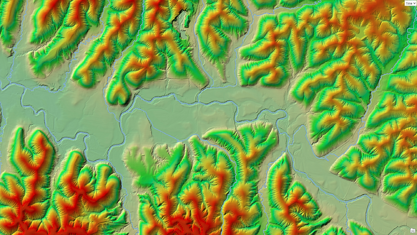
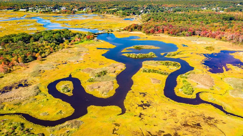
The Stillaguamish watershed in the Puget Sound basin was selected for the pilot based on available lidar data, variety of topography, land cover, varying jurisdictions, and willing local participation. Newly created steering and technical committees, made up of representatives from stakeholder organizations, provided oversight for the project. These committees met monthly throughout the project. Quarterly meetings included the full statewide stakeholder community (anyone interested in hydrography). Keeping the stakeholder community informed on the progress of the project was necessary to provide updates and solicit feedback.

Before the contracts were signed for this project, however, USGS announced a plan to discontinue the editing and updating process for the NHD, and instead transition to the new 3DHP model. This announcement impacted the pilot project, changing its goals and direction to better align with the 3DHP. Instead of focusing on having a final product submitted through the NHD process, the focus was shifted to meeting specifications for the new 3DHP and determining if that would meet the hydrography needs of Washington stakeholders.

Consulting agency NV5 was selected to work on the pilot project, providing elevation-derived hydrography (EDH) that met the new 3DHP specifications. NV5 already had a contract with the Washington Department of Natural Resources to collect lidar imagery, with a provision to also provide EDH work. As a USGS geospatial products and services contractor with experience performing EDH for the 3DHP, NV5 was a great fit for the pilot project.
The WASHD team compared the results from NV5 with any data that seemed relevant. This included working closely with local jurisdictions, using aerial imagery, hillshading images, and creating EDH data using traditional flow accumulation techniques. In total, over 7,000 miles of EDH lines were evaluated and classified for accuracy. Through analysis comparing the new EDH with available data, less than 2 percent of the EDH segments were determined to have location errors. Another 2 percent were questionable and could not be resolved without a field visit. Overall, the accuracy of the new EDH was impressive and showed promise as a method to update the NHD.
When comparing the length of EDH flowlines to the original NHD flowlines, the total number of miles of flowlines was almost double. This increase is explained by the increase in new lines as well as added mapping detail provided by the new process. When comparing streams mapped in the NHD and then EDH, the length of the same streams increased by 2–18 percent. These differences can be seen in our story map created for the pilot project.

The increased number of flowlines impacted stream order across the basin. Reach order increased 25–120 percent overall. If applications are set up to use stream order, the output of those applications will be impacted by 3DHP and need to be reevaluated.

The distance between the NHD and EDH lines was compared to determine the accuracy of the original NHD flowline.
To do this analysis, flowlines were selected within each dataset representing the same stream (a process also known as conflation). Streams with the same name were compared individually using the USGS Geographic Names Information System (GNIS). Since named GNIS streams usually only include larger streams, non-GNIS streams were also conflated and their spatial improvement from the NHD to EDH was assessed. The results are shown below.

The GNIS streams tended to be relatively accurate in the NHD, and therefore were close in distance to the new EDH. Over 40 percent of the stream length was within 50 feet, and 85 percent of the total stream length was within 100 feet. While the accuracy of stream length was improved, having 15 percent more than 100 feet away is still important; however, it’s not as significant as the smaller unnamed streams. The streams without a GNIS name had 50 percent of their length within 50 feet, but 30 percent was greater than 100 feet from the EDH. The GNIS streams are likely more accurate in the NHD because larger streams are readily viewable in aerial images. They are also more typically used in planning, research, management, and so forth and are therefore of more interest to have correct. Many of the non-GNIS streams are in forested areas with canopy cover, making them difficult to view in aerial images. These seem to be the scenarios that really benefit from a lidar model approach to mapping hydrography.
In summary, the pilot project helped identify the technology, methods, datasets, and resources needed to refine and maintain the accuracy of the National Hydrography Dataset for Washington. The Improved Stream Mapping Pilot Project Final Report covers the results of that assessment, including an evaluation of changes in national hydrography mapping standards that USGS implemented.
OneHydro Discussion
Through the pilot project and discussions with stakeholders, a basic needs assessment was made. While accuracy of hydrography data was most important, some overall data gaps were also identified. Some of these gaps were already present and known, and others have been created by the transition from the NHD to the 3DHP.
For the purposes of this project, distinct datasets for which the WASHD program is responsible have been defined and are detailed below. This section will introduce and explain the concept of an integrated set of data and information for hydrography.

Together, these datasets create what the program will refer to as OneHydro, the data ecosystem for hydrography analysis and mapping. The final report provides more details and examples of the data gaps identified in the table below.

Changes from the NHD result in the loss of the following data features:
- Unique reach codes
- Perennial and intermittent flow categories
- Swamp/Marsh polygons
- Geometric networks
Geometric networks are considered a change only because they are not supported in Esri’s ArcGIS Pro software. Washington State has historically added stream order to each reach and reprojected the state dataset to State Plane South coordinates. After processing, the dataset has been made available to stakeholders and referred to as the WASHD version of the NHD.
The 3DHP data schema will be replacing reach codes with a main stem ID, which will be a unique identifier for the entire stream length. A new feature code to identify terrain breaches over roads can be used to locate culverts and is a new addition to the dataset. Washington State will be able to calculate stream order for reaches and reproject the dataset to State Plane South coordinates as was done for the NHD. In place of a geometric network, a trace network can be created to provide similar functionality of locating upstream and downstream reaches.
HydroPlus Data Layers
Stakeholders identified several important data attributes and layers. These layers, shown in the table above, are important and useful, but they are difficult to create and are outside the scope of the WASHD program. While the WASHD program recognizes the significance of these layers as part of a complete hydrography data ecosystem, the program can only support or encourage their creation. The long-term goal is the creation and integration of these data layers into the 3DHP and WASHD for a more complete dataset with improved analysis capabilities. The WASHD program intends to support the integration of the HydroPlus data layers to maximize the usefulness of the data for stakeholders.
Conclusion
The utilization of new technologies, particularly those based on elevation data, has proved instrumental in enhancing the accuracy and precision of hydrography mapping. The advantages of incorporating EDH are manifold. The increased accuracy in mapping water features leads to improved critical areas assessment, watershed management, and environmental monitoring. When the data is inaccurate, it either is not used or it can cause errors that interfere with assessments. This inaccuracy is likely the reason that few local government agencies in Washington State have been using the NHD. The cascading effect of local agencies not using and improving the same hydrography dataset is that their more accurate updates are not incorporated into the state’s hydrography dataset, making it even less useful.
The USGS 3DHP has set up a standardization for EDH for a more consistent nationwide hydrography product. Since watershed boundaries rarely follow jurisdictions, this consistency is important. While many methods exist for achieving EDH, we found that unless the process is specifically designed to meet the USGS 3DHP specifications, the data will vary enough to fail the USGS verification process.
One key advantage of adopting a standardized hydrography dataset is the potential for significant cost and time savings. A single, universally accepted dataset will streamline mapping processes, reduce redundancies, and ensure consistency across various agencies. This efficiency not only benefits governmental agencies and research institutions but also extends to industries reliant on accurate hydrography data, such as timber companies, natural resource consultancies, and urban planning.
However, despite the benefits of the 3DHP, it is crucial to recognize that additional data layers are still needed to further enrich the mapping process. Integrating diverse datasets, such as wetlands, stream permanence values, and active channel edges, can provide a more holistic understanding of aquatic ecosystems and contribute to a more comprehensive hydrography dataset.
As we continue to witness rapid advancements in technology, the future of hydrography mapping holds the promise of even greater accuracy, efficiency, and accessibility. Collaborative efforts in mapping hydrography datasets will be pivotal in harnessing the full potential of EDH. This will usher in an era where precise and up-to-date water feature information is readily available for a myriad of applications, ultimately contributing to more informed decision-making and sustainable resource management.
For more information on the Stillaguamish project, check out the website.
Stay Connected with Esri’s Water Team
ArcGIS is an extensive information system that enables modernization of workflows with easy-to-use applications for the field and office. Strengthen your organization with smart solutions that will increase efficiency and provide insight for decision-makers.
Visit Esri Water Resources web site for more information.
Join the Water Resources Community
Follow #EsriWater on social media: X | LinkedIn
Subscribe to the Water Industry newsletter “Esri News for Water Utilities and Water Resources“
About the author