Compliance is no longer just about enforcement—it’s about resilience, transparency, and smarter planning. Geographic information systems (GIS) are helping planning departments lead the way.
When communities fall out of compliance with zoning, building, or environmental codes, the consequences can be serious. Stalled growth, increased safety hazards, blighted neighborhoods, and environmental degradation all occur when violations are ignored. Planning departments play a central role in protecting communities, and in today’s data-driven world, GIS is an essential tool in meeting this responsibility.
From streamlining inspections to targeting interventions, GIS enables planners to standardize and streamline their compliance workflows, respond proactively to issues, and build safer, sustainable, and thriving neighborhoods.
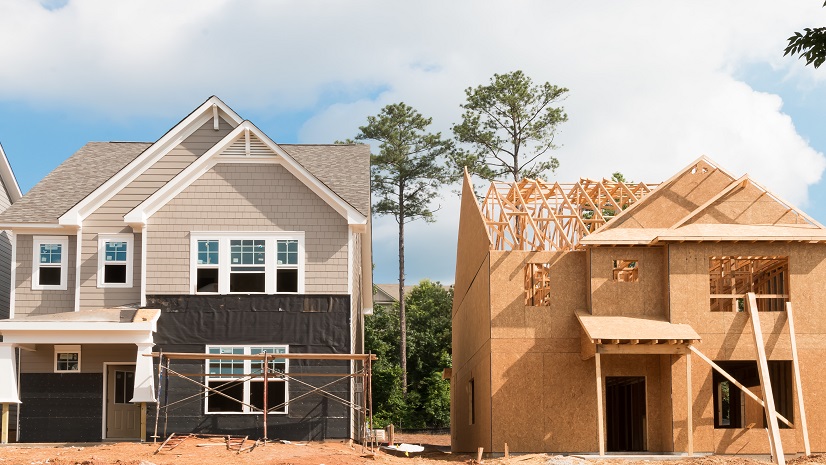
Digitize Field Inspections for Speed and Accuracy
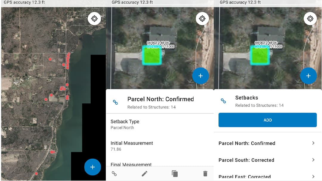
Traditional field inspections—pen, paper, and clipboards—are time-consuming and error-prone. This is true even with standardized forms. GIS-enabled mobile apps now allow inspectors to collect standardized data in the field using smartphones, tablets, or laptops. Information, including geotagged photos and condition assessments, syncs instantly with back-office systems.
This real-time flow of data improves efficiency, reduces administrative overhead, and enables quicker resolution of compliance issues. Everyone in the field and in the office are on the same page. It also ensures consistency across inspections and creates a defensible audit trail—critical for legal and regulatory reporting.
Measure and Manage Risk at the Neighborhood Level
Every community faces risks—wildfires, flooding, structural instability, and more. GIS empowers planners to map, analyze, and track these risks by location. Using real-time spatial data, departments can identify vulnerable areas, prioritize inspections, and measure the impact of mitigation efforts over time.
By visualizing risk geographically and demographically, planners and community leaders make better decisions about where to invest resources. Where are the most vulnerable neighborhoods? What is the potential outcome of delayed or no action? Whether it’s reinforcing infrastructure, enforcing building codes, or coordinating with emergency management on mitigation efforts, GIS helps ensure those actions are targeted and effective.
Use Spatial Insight for Smarter Environmental Review
Environmental review is a cornerstone of responsible land use planning. But without accurate, real-time data, this process can be slow and inconsistent. Esri’s Environmental Review solution allows planners to overlay development proposals with key ecological data layers—such as wetlands, flood zones, habitat areas, and severe slope—so impacts can be assessed early and objectively.
This not only speeds up the review process but ensures that development aligns with sustainability goals and regulatory requirements. With GIS, planners can catch potential environmental conflicts before permits are issued, creating a smoother path for both applicants and regulatory agencies.
Stabilize At-Risk Neighborhoods with Targeted Intervention
Compliance violations can often be indicators of deeper systemic issues. Repeated code infractions, illegal units, or deteriorating buildings may point to broader neighborhood instability. Invariably, these conditions did not happen overnight. They occurred over time. GIS enables planners to track and analyze these trends over time, helping them detect early warning signs.

With this insight, planning departments can deploy targeted interventions—such as community outreach, rehabilitation programs, or policy adjustments—to stabilize neighborhoods before conditions worsen. They also have authoritative analysis to gain buy-in from city and county leaders. By turning data into action, GIS supports a proactive, fair, and sustainable approach to community preservation.
Promote Accountability and Transparency
In today’s environment, public trust hinges on transparency. GIS helps planning departments build that trust by visualizing compliance activities on easily digestible maps and dashboards. Whether used internally or shared with the public, these tools clearly show where inspections are happening, how violations are addressed, and where progress is made.
Departments can also use GIS to track performance metrics and report on key outcomes, helping justify budget requests and program expansions. Internally, shared data environments reduce silos and enhance coordination between planners, inspectors, and partner agencies.

The GIS Platform for Modern Planning and Compliance
GIS is more than just a tool for mapping—it’s a platform that integrates data, analytics, and workflows across the entire compliance lifecycle. Esri’s planning system provides the data, tools, and solutions to connect the field to the back office, streamline reviews, and provide decision-makers with the intelligence they need to act quickly and effectively.
By bringing together inspection records, permit data, risk layers, and trend analytics, GIS empowers planning departments to make informed and justifiable decisions—and to do so with transparency, consistency, and foresight.
Enforcing the Rules and Shaping the Future
When compliance breaks down, communities suffer—growth slows, risks rise, and trust erodes. GIS is helping planning departments move beyond reactive enforcement and toward proactive, data-driven governance. With the ability to monitor, analyze, and respond to compliance challenges in real time, planners are not just upholding the rules—they’re creating the conditions for safer, more equitable, and more sustainable communities.