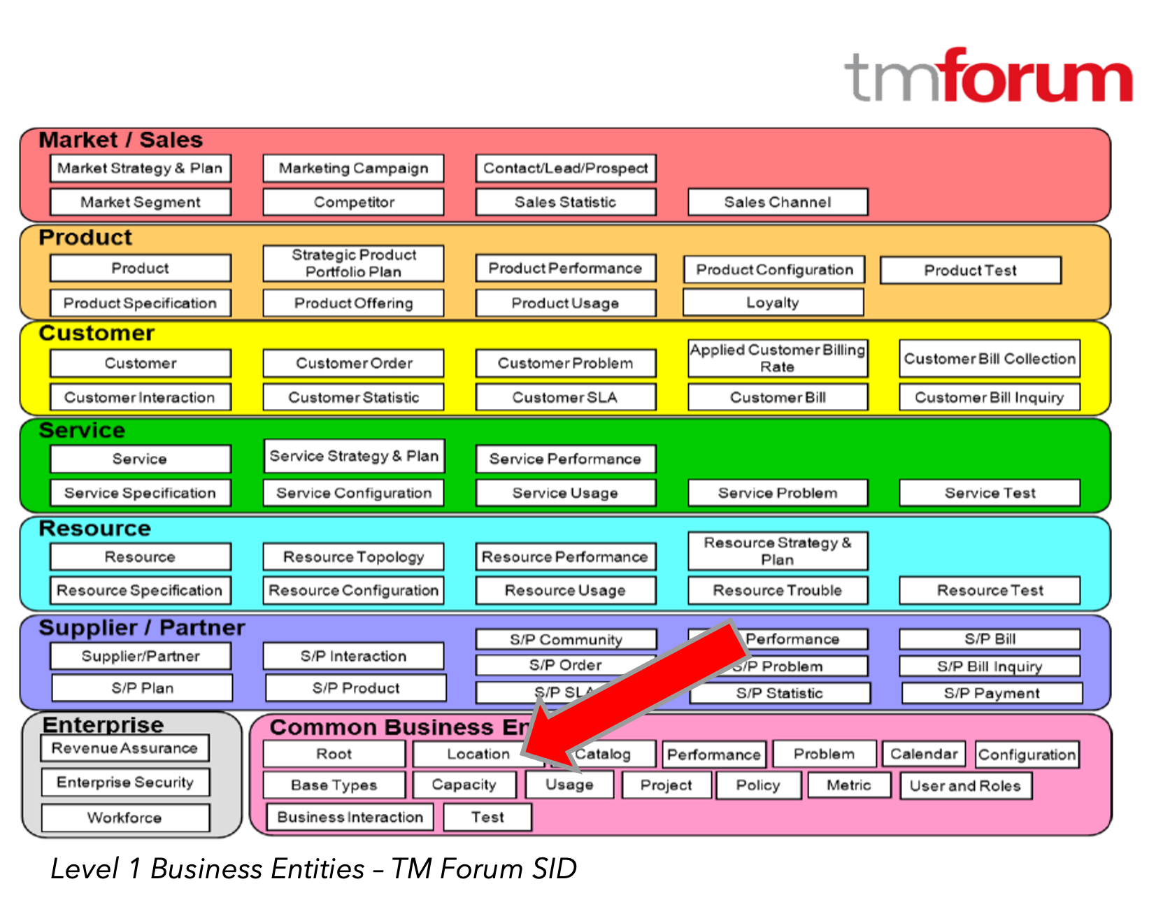
Location intelligence within telecommunications has no doubt evolved over the years. Mapping and geographic information systems (GIS) were once solely relied on to support engineering functions and network as-built support. Today, location intelligence is starting to be leveraged across the organization to support the whole customer journey and network roll out, from planning, to fulfillment, to assurance. The TM Forum, an organization who helps CSPs and digital service providers digitally transform their organizations through open standards and APIs, lists ‘Location’ as a Common Business Entity within their Information Framework (SID) standard.
The TM Forum, who also provides open location APIs for exchanging location information across the enterprise is hearing from their CSP members that there is a need for location and geographic based standards. Today, the telecommunications’ industry realizes location matters, and the secret sauce that mapping and GIS can offer shouldn’t be kept to just the engineering groups.
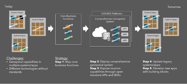
But within the industry today, much like other legacy systems and apps under the OSS/BSS umbrella, there are legacy mapping and GIS systems that are siloed point solutions that lack interoperability with other apps. So as new digital ecosystems are architected to support NextGen OSS/BSS, CSPs should consider geospatial strategies that leverage open and interoperable geospatial systems that can provide standardized location intelligence. Geospatial systems that align with an open API vision and can offer an architecture that fits a bare metal deployment, a cloud native deployment, or a hybrid deployment. By implementing a geospatial strategy and standardizing on an open geospatial system, organizations can reduce technical debt of legacy mapping and GIS tools that are not reusable assets for new business applications and processes. Many organizations are following a similar geospatial strategy as shown in the figure below.
Esri’s ArcGIS is the only comprehensive geospatial system that offers open and interoperable geospatial infrastructure that can be deployed on bare metal, in a cloud native environment, and leveraged as a SaaS or PaaS.
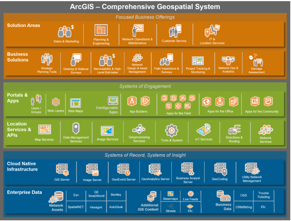
ArcGIS provides location data management capabilities for 2D/3D enterprise data and imagery, spatial analysis and data science tools, and standardized mapping that is all exposed through open location services and APIs. Built on top of this cloud native containerized infrastructure is a system of engagement framework for securely managing user access to location services and map layers. A centralized geospatial portal provides a content management system for the authoritative geospatial data across the enterprise. And the configurable ArcGIS web and mobile apps, and developer SDKs allow for agile app development in support of business processes that crosscut sales and marketing, planning and engineering, network operations and maintenance, customer service, and IT.
ArcGIS, as the only comprehensive geospatial system for telecommunications, helps to transform the OSS/BSS digital ecosystem with re-usable location intelligence assets. Esri, as the world leader in mapping and GIS, has been helping CSPs with their geospatial strategy since 1969. We continue to advance location intelligence capabilities in ArcGIS based on direct input from CSPs and look forward to working with your organization to bring a geospatial strategy to NexGen OSS/BSS ecosystems. If you would like to learn more or would like to talk with one of our geospatial experts, visit www.esri.com/telecommunications.