CHALLENGE
Every year, energy companies are tasked with ensuring that assets like overhead power lines, towers and poles are free from damage and do not pose a risk to residents that would prevent the transmission and distribution of power. In order to ensure safety and performance, energy companies often send teams into the field to inspect all aspects of the transmission and distribution of electricity. This process can take many hours and even days to perform and then once an issue is reported, can take additional time and resources to fix. In a post disaster situation diminishing “downtime” is a high priority to ensure as little disruption to the customer and company.
With today’s increasing expectation to quickly remedy issues, inspectors for energy companies are looking for faster and more cost-effective ways to assess damages in multiple areas simultaneously and in less trips. They are also looking to prioritize field work and create clear and concise reporting online. Most inspectors do not have a GIS background but need to provide geographic context in their reports.
SOLUTION
A utilities inspector can use the ArcGIS Excalibur app to remotely identify damages or potential risks along a utility network using drone images taken with Site Scan for ArcGIS. Observation layers can be created in ArcGIS Excalibur to mark up and geolocate the area in need of repair or attention and provide details about the damage seen in the images. The annotated images can then be exported into a report to brief and direct the mobile workers responsible for fixing the damages.
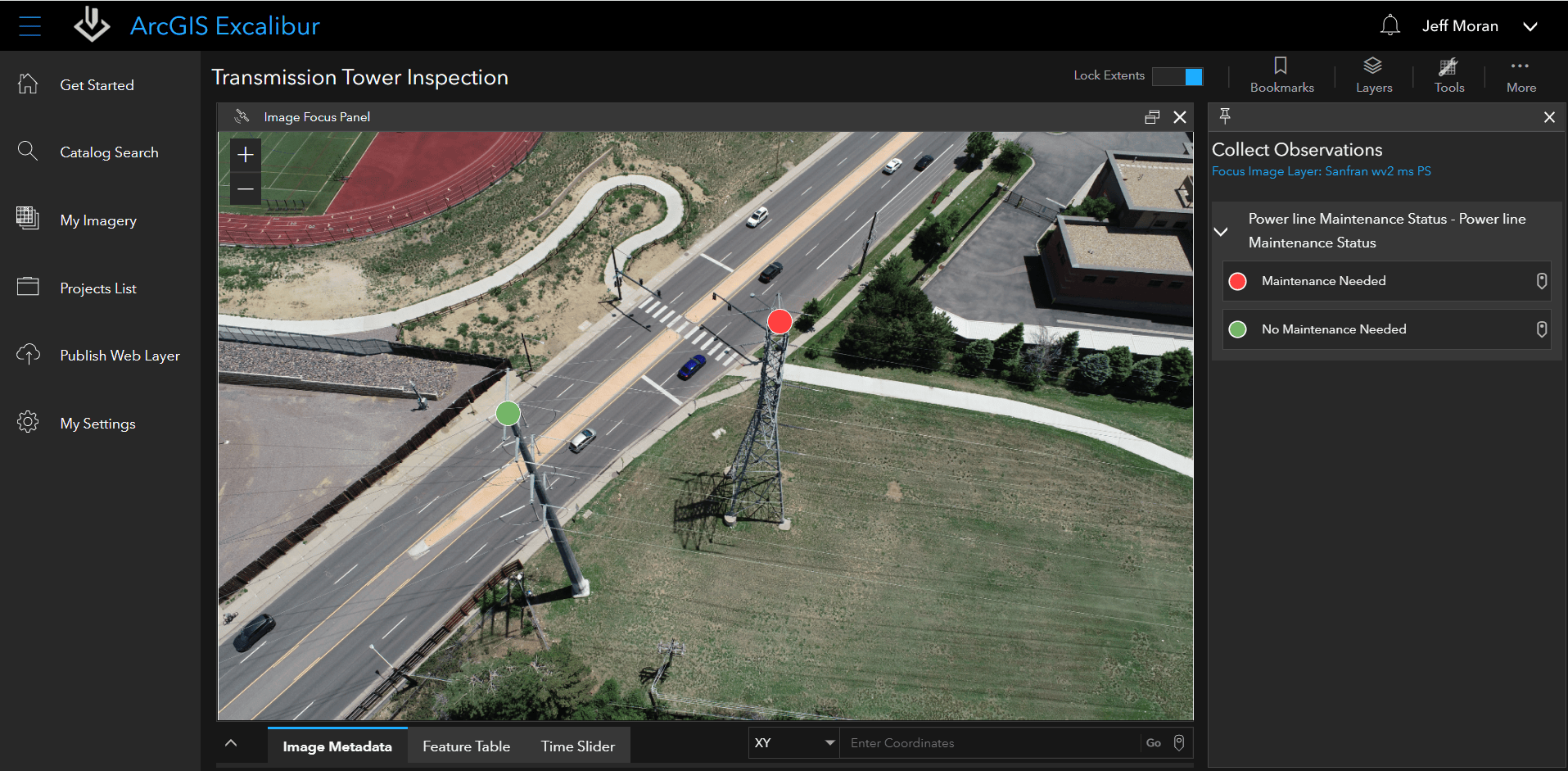
The inspector can also use the observation layers to configure a fieldwork project in ArcGIS Workforce to help the workers identify these locations in the field. As the observation layers are updated in ArcGIS Excalibur, the layers automatically update in ArcGIS Workforce as well. For awareness to stakeholders and executives interested in tracking the progress of work, the inspector can use the same observation layers to configure a dashboard using ArcGIS Dashboards.
The mobile workers can use ArcGIS Workforce to arrive to the power line location that needs repair. They can then access the observation layers from their mobile devices, repair the damages, and report back – all in one trip. Mobile workers can be assured that they are working on the correct power lines– a task that may have previously taken two or more trips – one for discovering the damage and another to fix it. However, with ArcGIS Excalibur, the discovery phase is all done remotely with images by the inspector.
BENEFIT
Because an inspector can perform an assessment remotely using ArcGIS Excalibur and workers in the field can locate, access reporting, and make repairs or address risks in a single trip, the energy company can save on time, reduce travel expenses, and work more efficiently. More importantly, they can prevent interruptions in service. Overtime, the energy company can refer back to the dashboard and pull data from routine inspections like this one to help respond to emergencies faster and avoid public safety power shutoffs.
Additionally, the utilities inspector does not require a GIS background. ArcGIS Excalibur allows anyone to work with imagery and seamlessly integrates with other ArcGIS apps for operational intelligence purposes.
GET STARTED
To learn more about ArcGIS Excalibur and add it to your organization’s ArcGIS Enterprise deployment, get in touch with an Esri representative. Also, get the latest news on the ArcGIS Blog.


Article Discussion: