Millions of us are confined to our homes as we witness the slow-motion evolution of the COVID-19 pandemic. Waves have replaced hugs, videoconferences have substituted (however poorly) for face-to-face conversations. Meanwhile, our hands chafe from repeated scrubbings, and we struggle to balance work and family needs.
An additional consequence of social distancing: We’re missing not just the people we love, but the places we love. With the one big exception of home, the locations that we cherish, and that renew us, are frustratingly out of reach.
Although we may be confined to our homes, we can still conjure up beautiful locations in our mind’s eye. I’ve found that going through my photo archives of past vacations is therapeutic. Clicking through holiday pictures provides an easy escape, and a reminder that, sooner or later, we’ll be back out in the world, relishing its endless beauty and variety.
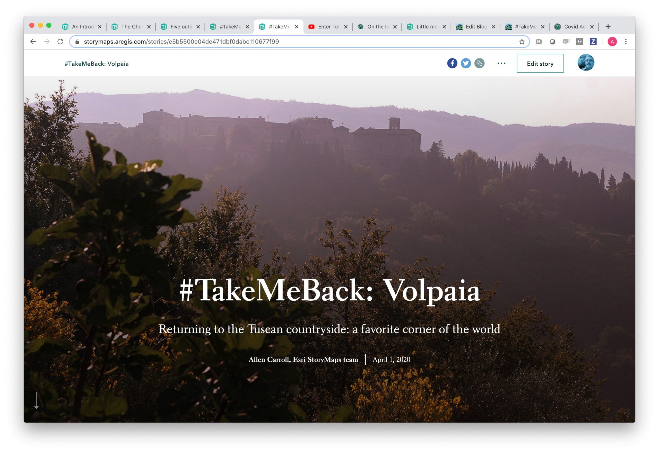
As I was clicking through pictures from a family trip to Italy, my story map fingers started to itch. One of my family’s favorite corners of the world is a relatively obscure hillside amidst the vineyards and olive groves of Tuscany’s Chianti Classico region, between Florence and Siena. More or less on the spur of the moment I started to put together a story map about our little country inn, and an outing we took to the nearby village of Volpaia.
That exercise in therapeutic storytelling led to a bigger idea: that we invite members of our growing storytelling community to create story maps of their own special locations and memories. Thus we invite you to rummage through your photos and souvenirs, and to create a story map about a place that’s close to your heart, and to share it with us. We’ll feature the best of them on our collection page.
Getting started
Step one in creating your story map: Turn off the TV. Nothing breaks the storytelling spell like a bloviating anchorperson. I’ve limited my exposure to the news to certain times of the day, and to catching up with things online rather than via television.
Next, gather your material. Are your digital photos on an external hard drive? Do you have old snapshots stored away in shoeboxes? Have you collected postcards and souvenirs from past vacations? Rummage through your closets, your bookshelves, and your folders. Gather, assess, and organize your digital and analog assets.
Once you’ve assembled your material, pick out the most striking and memorable images. Try to include a mix of image types. Scene-setters can help establish a vivid sense of place. But don’t solely feature a series of tourist-style snapshots. Adding close-up portraits and personal moments will make your story much more personal, and will increase its emotional impact. Those throw-away snapshots of random, even goofy moments are often the ones that evoke the strongest and happiest memories.
Here’s a blog post with some useful advice about how to plan and outline a story map.
If you have a scanner, you can digitize prints and postcards. If you don’t, taking pictures of your pictures with your mobile phone can work surprisingly well. Try to find a spot with even lighting—near a window is usually best. Don’t worry too much if your snapshots and scans aren’t perfect. Faded colors, creases, and slightly blurred images can add charm and individuality to your story.
By the way, creating a story map of a special place makes for an ideal family activity. Recruit your kids as storytellers, and ask them to choose their favorite places—and favorite images. You might even give them the authoring role; you can sit back and advise (and veto!).
The location or vacation you choose to depict might be based on the quality of the material you’ve unearthed. Perhaps a more important criterion is how meaningful a location is to you. Location, emotion, and memory are closely interlinked. Choose a place to which you’re emotionally attached, and with which you associate happy memories.
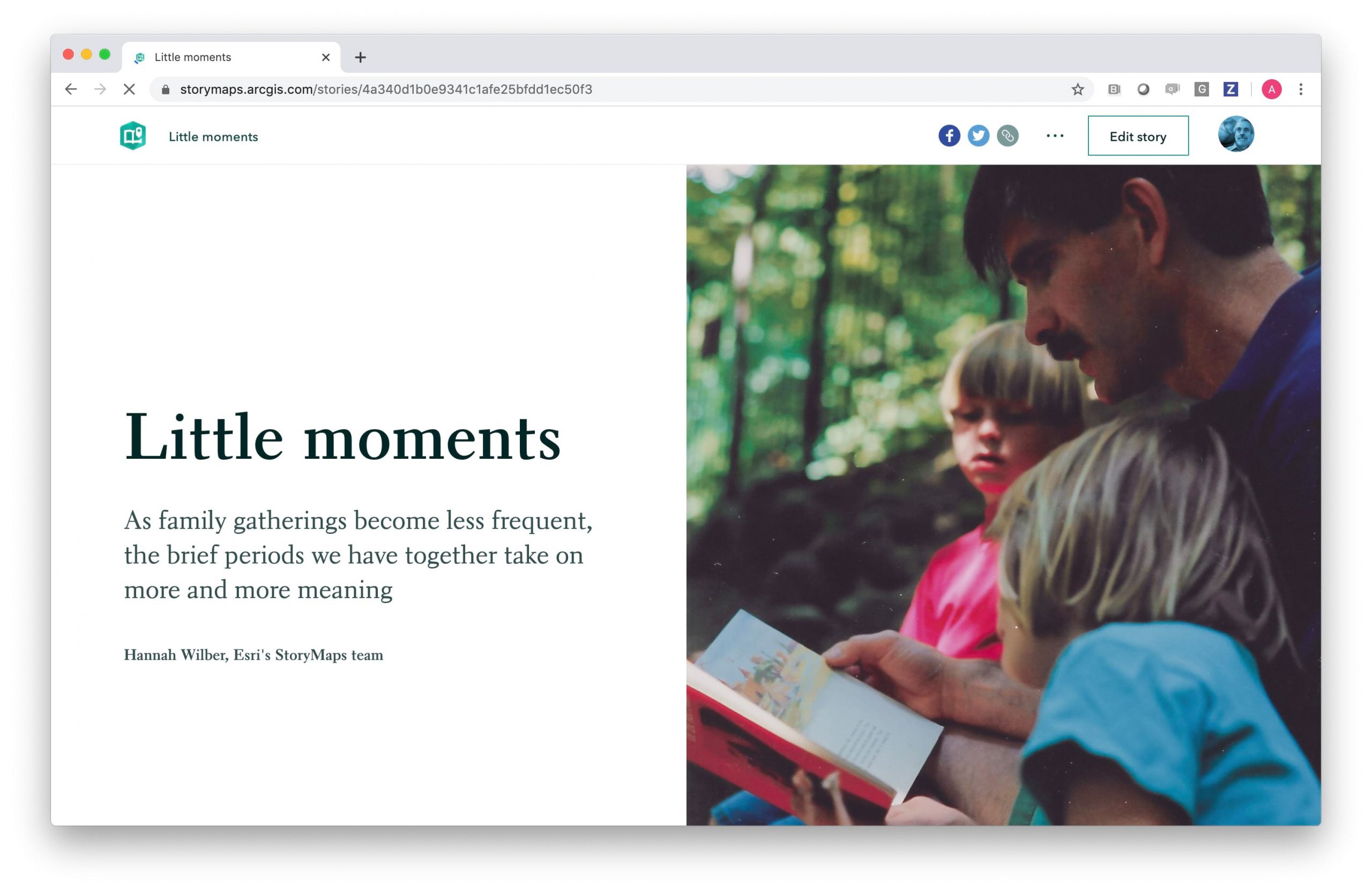
You may want to chronicle an entire vacation, including multiple destinations and outings. But I suggest you consider focusing on a single day, or a single excursion. That’s what I did for my story on Volpaia. If you’re really ambitious, you can reminisce about multiple summer gatherings, as did my teammate, Hannah Wilber, in her superb story, “Little moments.”
Using immersives
We hope you’ll create your story map using ArcGIS StoryMaps. (But using one of our classic templates is OK, too.) ArcGIS StoryMaps gives you not only the default, scrolling experience, but it offers three immersive blocks that can really enrich your narrative.
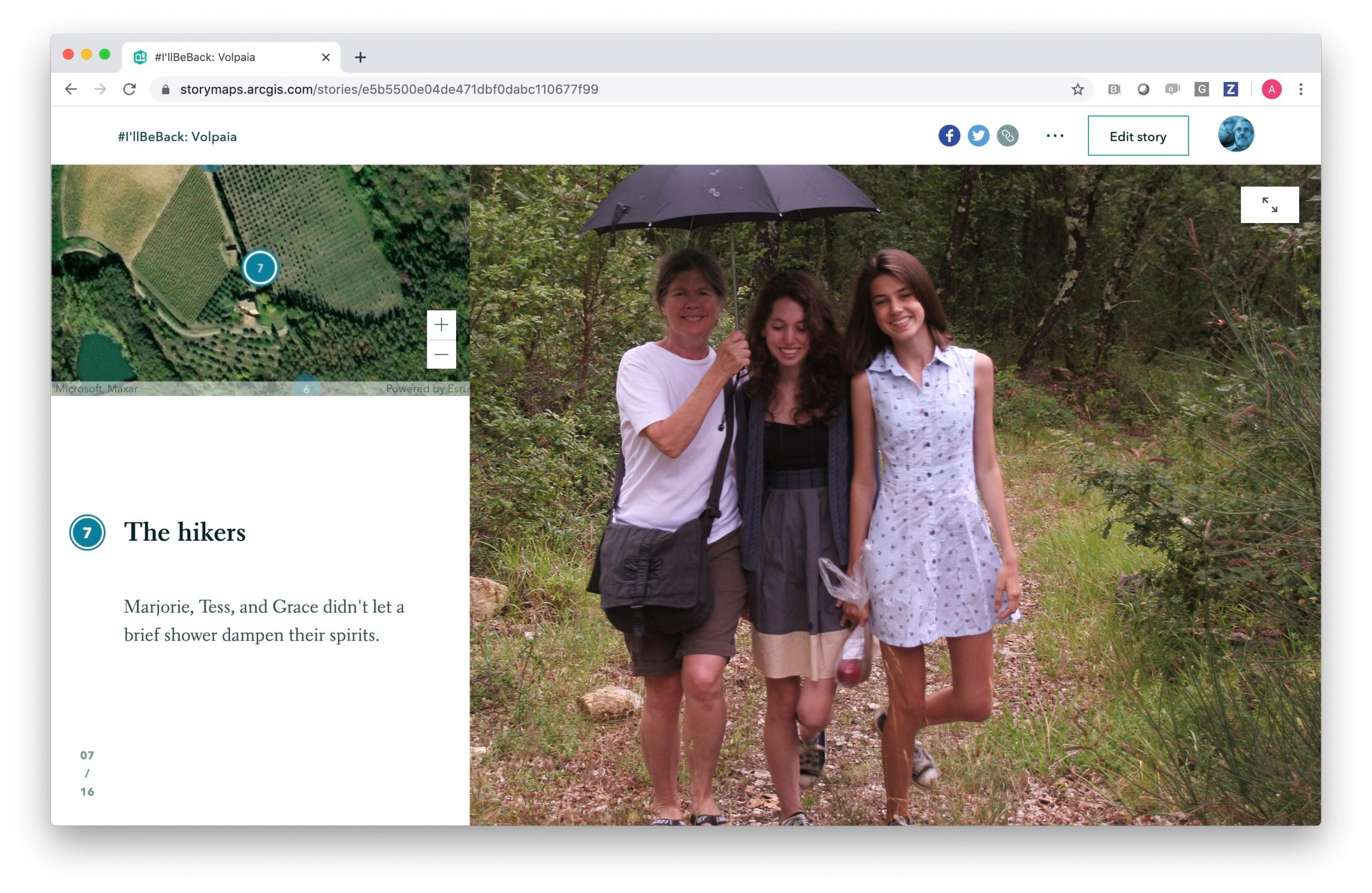
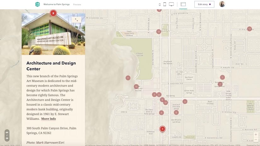
My Volpaia story uses our guided tour immersive (here’s a blog about guided tour). Its combination of map, images, and text provides an ideal way to depict hikes or outings that go from point to point. Experiment with its two layout options, map-centric and media-centric. I usually prefer the media-centric layout for vacation narratives, but you should use your own judgment. You can switch back and forth with a single click.
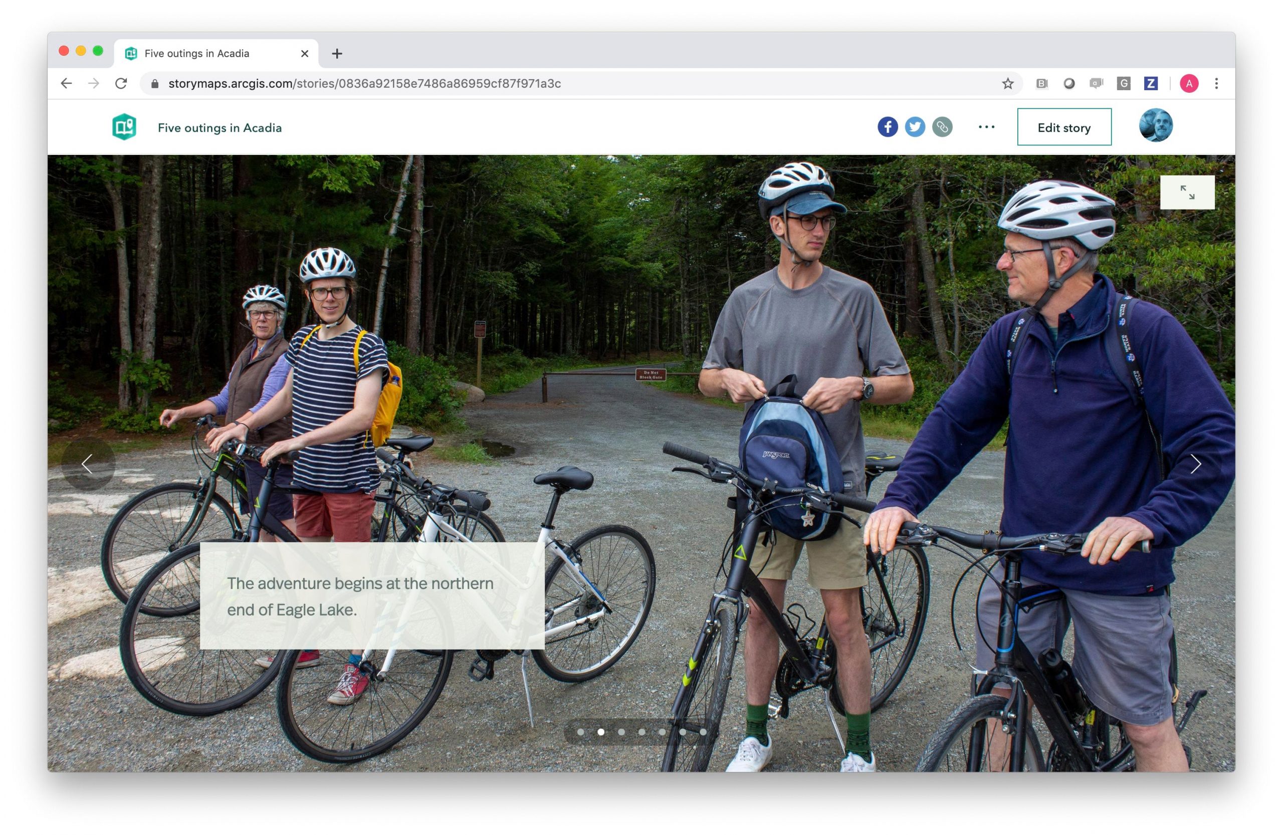
For my “Five Outings in Acadia” story map I used the slideshow immersive (slideshow blog here). It’s great for featuring a series of images on a single topic, outing, or event for which descriptions are brief. You can easily reposition the floating caption box to suit individual pictures. Its horizontal sequences offer relief to “scroll fatigue” which affects some readers. Hannah’s “Little moments” story shows how effectively slideshows can be incorporated within a longer scrolling narrative.
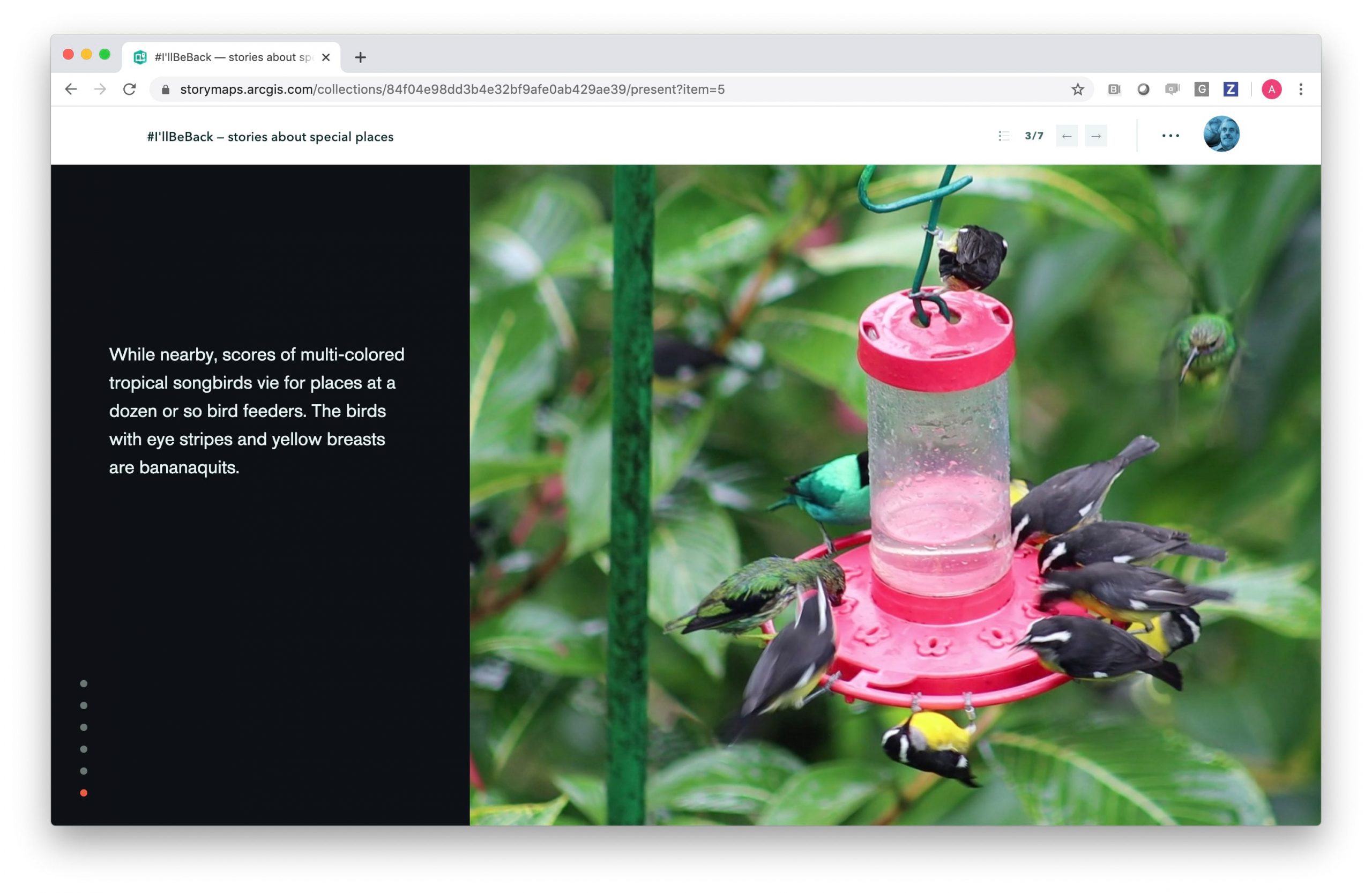
Finally, there’s sidecar—which I used for my story about a visit to the Asa Wright Nature Center in Trinidad (I also incorporated a couple of slideshows). Here’s a blog about sidecar. The narrative panel nicely accommodates longer narrative text (and multimedia content). And since most of my story took place at a single location, I didn’t need guided tour’s point-to-point maps.
All three immersives utilize a similar builder experience, with a carousel of thumbnails that let you easily add, delete, and reorder items in your narrative.
Regardless of your choice of immersive, choose your cover image with care. I prefer images that evoke rather than explain. My Volpaia cover shows the village in the misty distance, even though I have pictures that provide more detail. I hope the cover whets readers’ appetite and piques their interest. I also like to set the scene and context with an introductory section—but you should decide what works best for you.
We hope you and your family will enjoy creating your story. We think the creative process will lift your spirits. And we look forward to seeing the fruits of your labors.
How to share your memorable location
When you’ve published your story, please share on Twitter with the hashtag #TakeMeBack and #StoryMaps, and we’ll add our favorites to our collection.
Thus we invite you to rummage through your photos and souvenirs, and to create a story map about a place that’s close to your heart, and to share it with us. We’ll feature our favorites on social media and the #TakeMeBack collection page.


Article Discussion: