The ability to upload items directly to Hub is now here. This means that members of the site’s core team, including stakeholders from your community, can easily upload single files, including spreadsheets, documents, and PDFs, to the site’s search catalog. This initial release also includes the ability to provide basic metadata and a thumbnail image for the new item using the content details page.
Upload a file
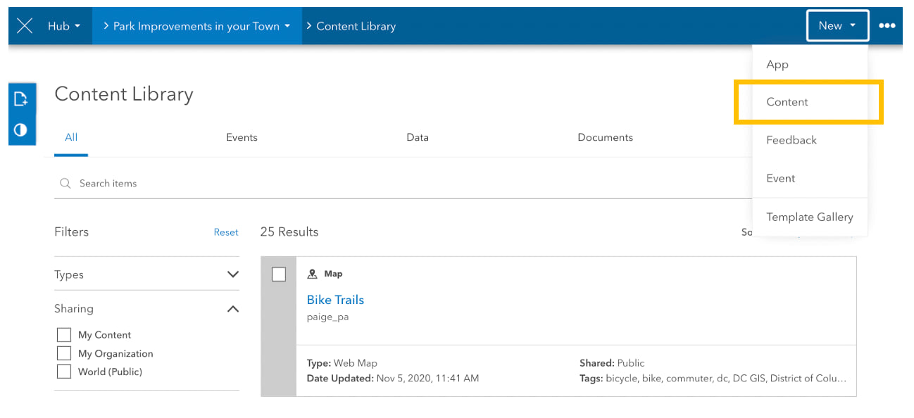
To get started, open a site in edit mode or follow these steps to create one. Then, click the second dropdown menu in the edit bar and choose Content Library.

Click the New button in the edit bar and choose Content.
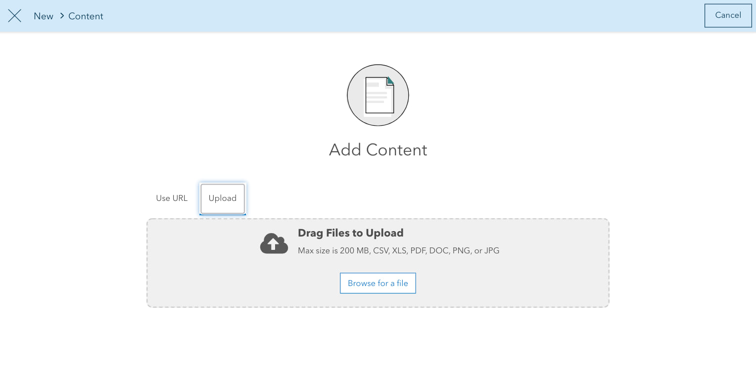
Click Upload and choose a file from your desktop. Supported formats include .csv,.xls, .pdf, .doc, .png, and .jpeg files. The maximum file size is 200 MB.
Add metadata
Next, fill out the item’s metadata. Required metadata include a title, description, and tags. The source is listed as the default name of the Hub’s ArcGIS Online subscription.
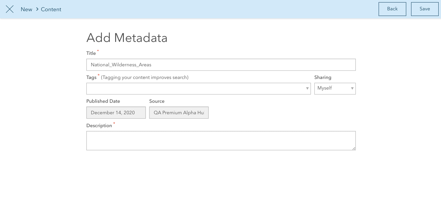
The metadata you provide are displayed as search results and on gallery cards added to your site’s layout. Once the form is complete, click Save. All uploaded items are shared with you (the item’s owner) and the site’s content group. To share the item with your core team, organization, or the public, see Set view and edit access.
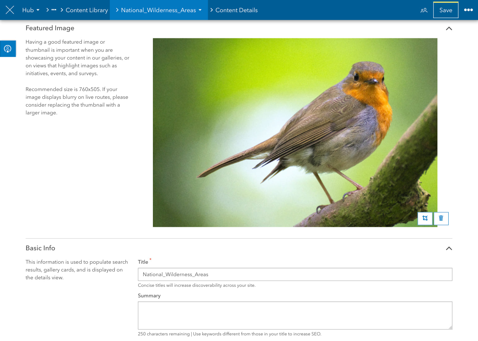
Choose a thumbnail
You can optionally add a thumbnail to your new item. It’s useful to provide a thumbnail if you plan to feature the item in a gallery. You can update the thumbnail by visiting the Content Details page. To access this page, open the site’s content library and click on the item to open it in edit mode.
Next steps
Future releases will continue to build on this new functionality by adding support for larger files and more file types. These releases will also include expanded metadata fields, including picking a thumbnail and adding a summary, and the ability to upload multiple files at once. For release notes, see the Hub Changelog and follow us on Twitter for updates.
To learn more about content sharing in ArcGIS Hub, see Content basics and How to add content using ArcGIS Hub.


Article Discussion: