About a year ago, in a pre-pandemic time when we could travel the country freely without much worry, a colleague of mine and I were preparing to present the ArcGIS Seminar Series. He said to me, “Hey, do you remember when we just had two products? That would have made for a simpler seminar series.”
He’s right. It would have. But, those two products (ArcInfo and ArcView) were almost exclusively made for GIS professionals. That’s not a bad thing, in and of itself. GIS professionals (should) understand the concepts of geography, so it only makes sense that the software just works for them. There was a problem with that, though. They’re not the only profession whose work is impacted by geography. My mind always goes to planning and economic development at this point, having been a planner for many years. One of the most famous acronyms in planning, N.I.M.B.Y., is based on geography.
Fast forward to today, and yes, there are numerous GIS programs and solutions out there. I work for Esri, and it’s even overwhelming for me at times to keep up with everything being developed. The reason these tools, these solutions, these apps are being developed is because there is a modern expectation to access maps. There is a modern expectation to analyze location. There is a modern expectation to collaborate with anyone, work anywhere, and do so on just about any device.
So, as these developments continue to progress, I wanted to find the best way to communicate this to the planning profession. Instead of trying to cover every product, I wanted to find a way to brief planning professionals on what specific apps mean to them.
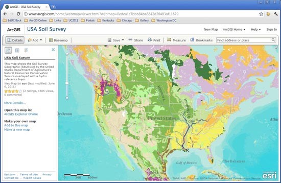
ArcGIS Pro – This is the evolution of traditional desktop GIS. As a planner, you probably only need this if you’re responsible for creating and maintaining authoritative data, such as parcels, zoning, hydrology, street networks, and so forth. It also provides tools and modeling ability to perform geoprocessing and analytical tasks from simple routes and buffers to rendering 3D buildings. If you don’t use this, don’t worry! Most planners today receive their authoritative data from another source.
Good news for planners: Everything after this is either web or mobile-based.
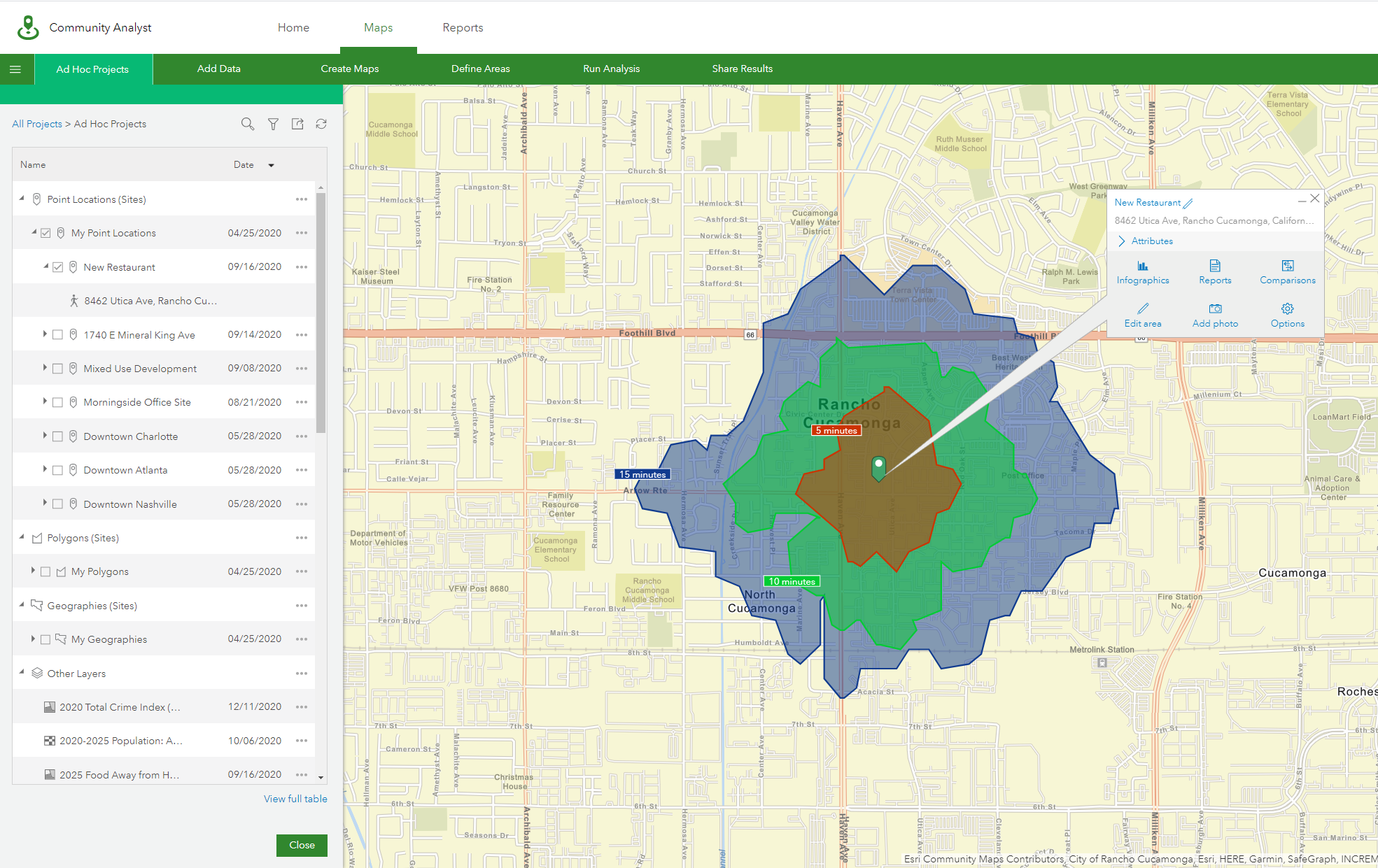
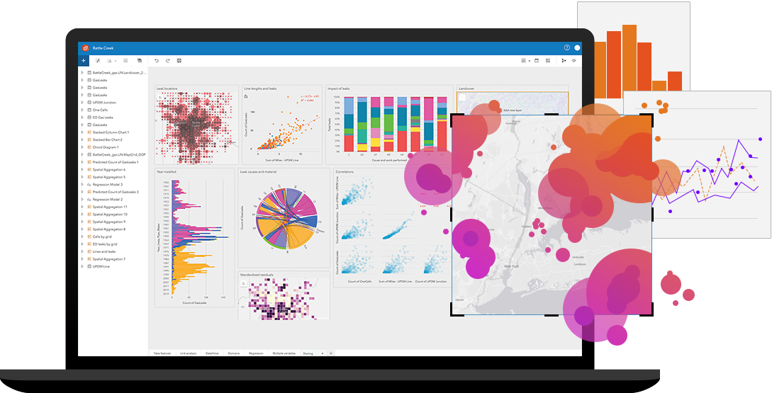
ArcGIS Online – Consider this your web-based content management system. You can create and share web maps in a secure environment, perform many common analysis functions (e.g. closest transit stop to an office park, walkability analysis near a facility, simple and complex routing, etc.). You can create groups for projects or groups that meet your departmental structure. And you can access your content securely from anywhere with an internet connection.
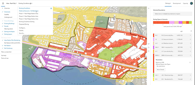
ArcGIS Urban – This web-based add-on to ArcGIS Online provides tools to develop, visualize, and analyze proposed developments and land use changes. So, when a developer submits a plan that achieves 60% of what you’d like to see for a development, you can configure the plan to show the positive impacts of achieving the other 40%. It provides a data-driven approach to development by measuring key metrics (e.g. population, household, jobs, traffic, infrastructure, etc.) of your proposed development.
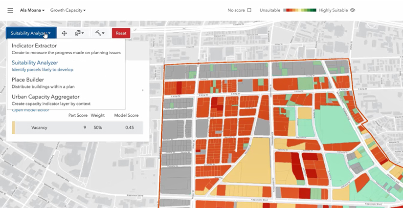
Now, there is an additional app that works with Urban called the Policy Validation Application (PVA). PVA lets you take a high-level look at the most suitable locations for certain types of development, whether your focus is on affordable housing, homeless resources, measuring growth capacity for a neighborhood, or examining racial equity in a community. This is a separate app now but will be integrated into ArcGIS Urban in the near future.
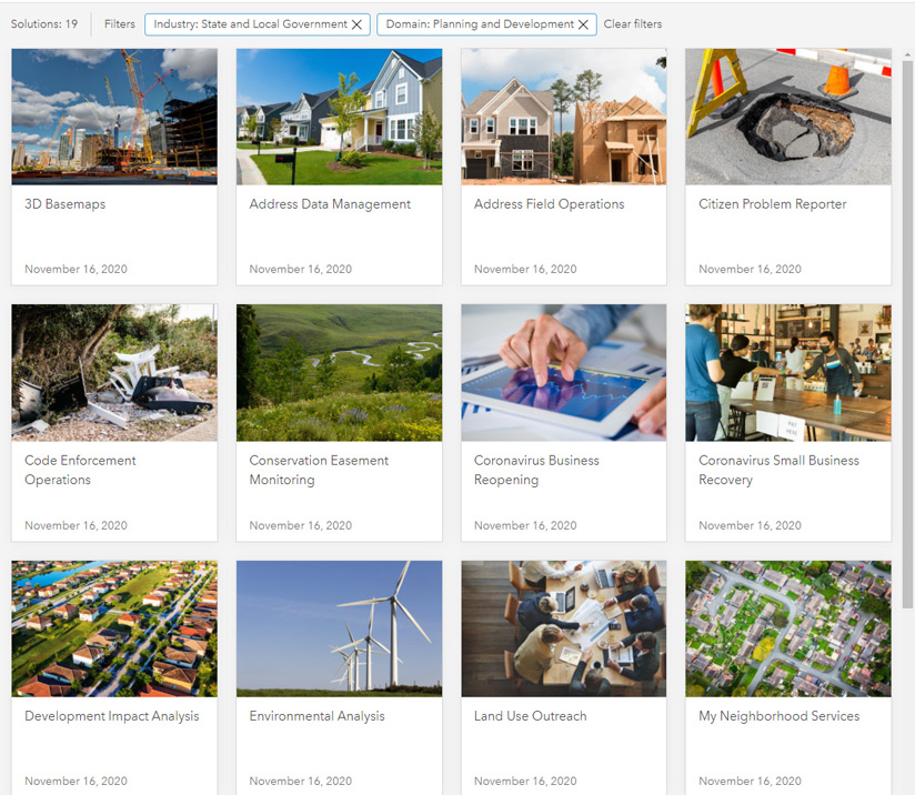
ArcGIS Solutions – These are a series of simple, focused apps addressing planning workflows, such as public notification letters, blight mitigation, development review, etc.. The apps are a part of the ArcGIS platform, so there’s no charge for any of them. They’re also all open source (great if you’re a developer), fully configurable (great if you’re not a developer), and fully supported by technical support.
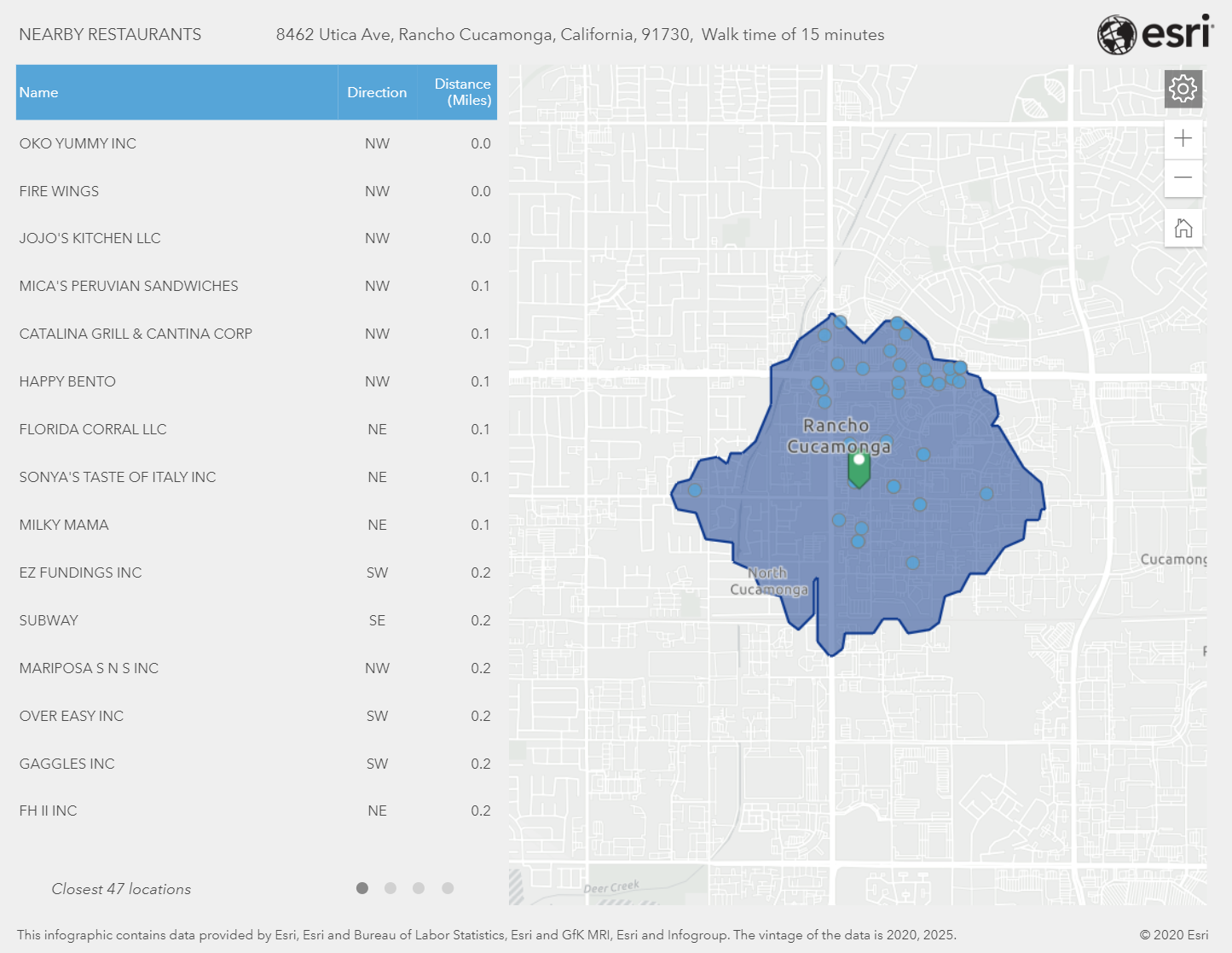
Business Analyst Web App / Community Analyst – This add-on to ArcGIS Online may still be my favorite. It’s a must have for any planning department, because it provides access to over 1,700 demographic, socio-economic, and business variables. This includes 5-year projections for most demographic datasets down to the block group level. It also provides tools to analyze the feasibility of certain sites for a business or other development. You can perform site suitability and some more complex economic development analysis, such as void analysis.
ArcGIS Hub – Once you have your maps, charts, documents, and so forth together, you’re going to want to make them available to the public in a manner that meets their expectations. Not just open data, but initiative-driven open data. ArcGIS Hub provides a modern way to frame your initiatives in a way the public can understand, and it provides a mechanism for them to communicate feedback to you through a map, a survey, or any other method you choose. Again, you don’t have to be a developer to put these together.
ArcGIS Insights – This is easily the least traditional GIS program you’ll find in this list. Think of it as a business intelligence tool for planners. The best use in planning I can think of is to load an output of your permitting data into Insights to gain a new level of understanding about the types of development that have occurred over time. How many commercial permits were issued in Councilwoman Tanner’s district last year? How does that compare to last year or 5 years ago? How many are in a “stop work” status? How many are within a 5-mile buffer of the new proposed office park? These are the types of questions ArcGIS Insights can answer. It really is an eye-opening app that generate a lot more value for your existing business systems.
Look, there’s more, and the geo-geek in me wants nothing more than to go over all of them, but that would defeat the purpose of this blog. What I listed above is a very strong foundation for how GIS can and should be used within a planning department to help make better, more sustainable, and more justifiable decisions.