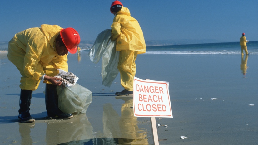
When a catastrophic event such as the Huntington Beach oil spill occurs, early responders urgently need up-to-date situational awareness and the immediately prior conditions of the impacted areas for damage assessment and context. Emergency response for unpredictable and rapidly evolving circumstances during events like this requires smart technology with a dynamic set of capabilities and accurate data layers to gain control of the situation, protect early responders and the public, and minimize further impacts. Smart technology like GIS provides an optimum framework for organizing, visualizing, analyzing, and disseminating this kind of information so that informed decisions can be made, appropriate actions can be taken, and the citizenry can stay updated and informed.
In many cases, up-to-the-minute imagery from a variety of sources provides the most authoritative “picture” of what is happening, and when we can see an image of something, we can understand it better. In emergency management, imagery is not only useful for situational awareness, but also historical / archive imagery gives us the context for change detection and damage assessment. Same-hour, same-day, on-demand tasking, and very recent imagery sources may include satellite, aerial, drone, and unmanned terrestrial vehicle imagery, and they can range in type from panchromatic, natural color, color infrared, multi-spectral, hyperspectral, and microwave (Radar) sensors. Available imagery sources include both no-cost or low-cost imagery from familiar government programs such as Landsat and Sentinel, as well as commercially available data from multiple vendors.
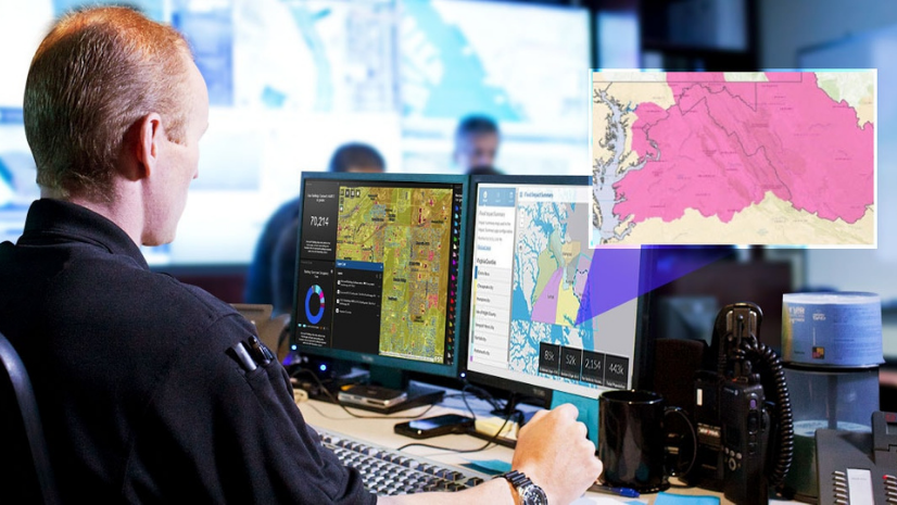
The ArcGIS system provides a comprehensive set of tools and capabilities that are particularly well-suited for disasters such as this, providing the necessary framework for visualizing, understanding, decision making, and taking action. Thousands of users worldwide deploy this system in similar operational settings at national, regional, state, and local levels. Included with ArcGIS is the ArcGIS Living Atlas of the World, which features the world’s most extensive collection of recent global high-resolution imagery, making it the preferred source of authoritative imagery content and optimal for identifying pre-event conditions on the ground as the basis for accurate change detection.
ArcGIS Image is a suite of advanced capabilities within ArcGIS that can dynamically access, display, enhance, and analyze all forms of available imagery and quickly provide actionable intelligence in the form of information products directly to responders in the field. A very useful source of data during a natural disaster is Radar data represented as an image. Radar “imagery” has several unique properties which are valuable during such a crisis, including the ability to “see” at night and in cloudy weather, something traditional optical imagery can’t do. Radar imagery is especially important for oil spills because the associated oil slicks on the water surface are readily apparent in the image, even in bad weather.
ArcGIS Image includes an extensive set of tools specifically designed to display, enhance, and process Radar data so that it can be accurately fit to a basemap, features extracted, and then combined with other GIS layers. ArcGIS Image can also quickly map and track changes to the oil slick location and extract its most recent boundaries for overlay on top of potentially impacted marine resources and other GIS layers. Other tools are available within the ArcGIS system to support predictive analytics, giving decision-makers insight into potential downstream consequences and associated impacts on property, marine wildlife, and other natural and economic considerations.