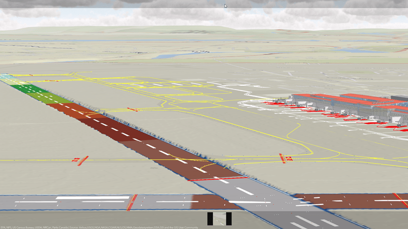
Throughout the planning, design, and construction phases of physical infrastructure projects, knowledge of the most up-to-date definition of ground remains essential. Characterizations of existing ground in design tools and modeling of proposed ground surfaces provide digital representations of the evolving topography, terrain features, and elevations across the project site. Surface models of existing conditions establish initial context in projects during the planning stage. Further, models of existing ground inform design decision making and accelerate convergence on proposed ground surface models. Together, existing and proposed ground surface models enable estimations of earthworks quantities such as cut and fill volumes, culminating in final ground conditions upon completion of the construction phase. In turn, subsequent projects undertaken in the same vicinity can leverage previously developed surface models as part of respective project planning efforts.
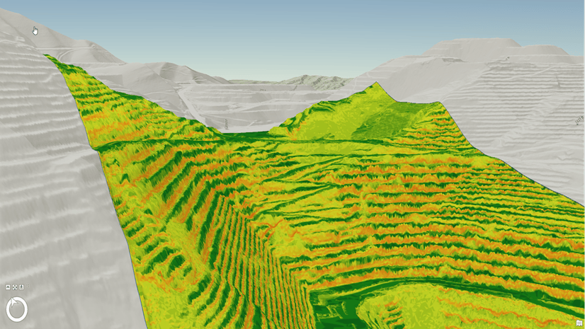
Autodesk® Civil 3D® is widely used by civil engineers, provides comprehensive design capabilities, and improves efficiency for a wide range of physical infrastructure projects, including those involving ground surface modeling. Element support and integration capabilities in ArcGIS Pro allow you to model surfaces originating from Autodesk Civil 3D, in which surface models typically conform to triangular irregular networks (TINs). Consisting of 3D points interconnected by triangles, TIN surfaces also include basic elements that reflect model extents, inner and outer boundaries, breaklines, and grading components for proposed ground.
New feature class support
ArcGIS Pro 3.2 extends integration support to more elements that influence generated points and triangles of TIN surface models. Access to these influencing elements, represented as newly supported feature classes in ArcGIS Pro, broadens the contexts and workflows available to GIS professionals for generating surface models. Collectively, the previously developed integration capabilities and newly supported feature classes allow you to generate surface models in ArcGIS Pro that uphold the accuracy of counterpart surface representations in Autodesk Civil 3D across a wide range of scenarios.
In ArcGIS Pro 3.2, four new feature classes are supported as part of direct-read processing of Autodesk Civil 3D files:
- SurfaceBorder—Polygon that represents the final limit of the surface and accounts for other Autodesk Civil 3D elements when present, such as boundaries and breaklines. In ArcGIS Pro, this feature class defines the actual extents of the surface model.
- SurfaceBoundary—Polyline that, when present, modifies the final limits of a surface model. Note that these polylines may also define an inner boundary of a surface. This feature class includes attributes pertaining to the type of boundary. Also, a dedicated attribute is included to indicate whether the polyline is a destructive breakline, based on how the element was defined in Autodesk Civil 3D. When present, the polyline influences the shape of the surface borders, but otherwise, the SurfaceBorder feature class takes precedence.
- Grading—Polylines that complement linear elements such as feature lines, which in turn comprise grading objects in Autodesk Civil 3D. This feature class does not participate in surface generation within ArcGIS Pro. To enable this form of representation in ArcGIS Pro, a surface must be created from the grading object in Autodesk Civil 3D. The corresponding surface can then be consumed in ArcGIS Pro.
- SurfacePoint—Multipoint that represents the points distributed throughout the TIN surface. This newly supported feature class replaces the SourceSurfPoint point feature class used in previous versions of ArcGIS Pro. Replacement of support for the point feature class to Multipoint geometry brings substantial performance improvements during direct-read processing of Autodesk Civil 3D files. In this context, Delaunay triangulation is performed on the collection of points to produce the triangles of TIN surfaces within ArcGIS Pro.
Existing feature class support
The newly supported feature classes listed above complement those that were already supported:
- Breakline—Polyline that is part of those constituent elements that influence a surface and is defined inside a surface in Autodesk Civil 3D to represent components such as curbs. ArcGIS Pro takes these polylines into account as part of surface model generation.
- Topography—Multipatch representation of the final surface defined in Autodesk Civil 3D. In ArcGIS Pro 3.2, this feature class supports materials that could be assigned to the surface in Autodesk Civil 3D. If the Autodesk Material Library is installed on the same machine as ArcGIS Pro, the assigned material will be rendered when the surface is added to a scene in ArcGIS Pro. However, this feature class is not necessary in ArcGIS Pro to generate a TIN surface.
Centralized, collaborative workflows for modeling ground surfaces
The collection of supported feature classes, which correspond to the constitutive elements of surface models in Autodesk Civil 3D, enable generation of highly accurate surface models in ArcGIS Pro. These feature classes also provide a basis for establishing centralized access to surface model components through feature layer publishing and use of feature services. Correspondingly, collaboration opportunities increase between civil engineers and GIS professionals, where modifications made to surface models in either Autodesk Civil 3D or ArcGIS Pro can be maintained in one system of record. Further, the collection of feature classes allows you to publish surface models as web scenes in ArcGIS Online and disseminate them to stakeholders for visualization purposes.
The blogs listed below provide additional discussion of the workflows related to surface modeling in ArcGIS Pro:
- Terrain datasets—Surfaces in a centralized location
- Terrain datasets as ground—Create scenes in ArcGIS Pro and publish to ArcGIS Online
The above workflows illustrate how to leverage Autodesk Civil 3D surfaces and newly available capabilities in ArcGIS Pro. However, the workflows are intended to be expanded and modified as necessary. Also, the above resources provide a basis for democratizing Autodesk Civil 3D surfaces; surface data no longer needs to reside within a file, which can lead to the negative effects of data silos. Instead, surface models become available for visualization and assessment to broader groups of civil engineers, GIS professionals, and stakeholders taking part in projects that involve ground modification.
If you’re attending AU 2023, join us on Wed. Nov. 15 for a Technical Instruction course: Digging into Surface Modeling with Civil 3D and ArcGIS.


Article Discussion: