The annual Esri User Conference was this week and once again the event was held virtually. So, as I sat in my home office and watched the opening plenary of the conference I found that I had to continually remind myself that the plenary was being filmed on the Esri campus in a building I use to work in. The stage that was built for the presenters in the plenary was an immersive augmented reality stage, and throughout the morning, speakers and the audience were transported from lush jungles, to fancy condos overlooking San Francisco, to the surface of Mars.
Now, this Hollywood magic may not seem like anything new, but powering these augmented reality scenes were digital twins of the real-world that were geographically accurate geographic information system (GIS) models combined with actual imagery of the environment, referred to as Reality Capture. Not only were these immersive augmented reality visuals pretty pictures, but they were true digital twins of the real-world that allowed for visualizing real-time sensors and modeling if/then simulations. The new ArcGIS Maps SDK for Game Engines was powering these visuals, but it was the GIS data combined with Reality Capture that made it all possible.
GIS has seemingly always allowed for organizations to map and model their business as a virtual representation of the real-world, however combining those GIS models with drone and aerial imagery, lidar point clouds, and derived 3D triangulated mesh’s in a 3D environment is the next step in creating that true digital twin. So, what does this mean for the telecommunications industry and the evolution of telecom network digital twins? Well, here are a few areas I believe digital twins powered by GIS will bring value to communication service providers over the coming years.
Network Planning & High-Level Designs
A few years ago, Esri started talking about the concept of ‘remote engineering’, which is all about bringing the field to the OSP engineer and reducing truck rolls. This is an area I think digital twins will have a major impact. Planning and designing 5G and fiber networks require an understanding of the real-world environment and ROW. Many times, field engineers are sent into the field to collect structure and ROW information and to verify designs or wireless signal strength. With access to a digital twin, engineers can generate accurate if/then designs with centimeter accuracy and have confidence that their proposed plans and costs are accurate without multiple trips into the field.

NextGen Network Management
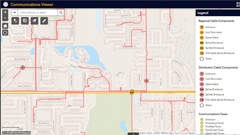
Network or asset management is the first use case that came to my mind when I first learned what a digital twin was. Modeling physical and logical networks in a virtual environment to visualize where network assets are, to run network and OTDR traces, and to better understand network capacity needs makes complete sense for digital twin technology. As more and more network architectures become interoperable with each other, and we as broadband consumers become more dependent on stable internet connections, having telecom networks modeled in a digital twin will allow for predictive network maintenance and proactive network operations to occur.

Service Qualification & Executive Insight
How many customers are affected by that outage? Where are the nearest Network Access Points? Who is serviceable in that building? When will the network be activated? These are questions I’ve heard from executive teams at telecom organizations over the years, and they could all be answered with better spatial awareness provided by a digital twin. Bringing together network data, business data, and customer data into one real-time digital twin ecosystem allowing for analytics to be run, and provides a visual representation of all that data in a real-world context, can drive faster service qualification and enable true executive insight into the business.

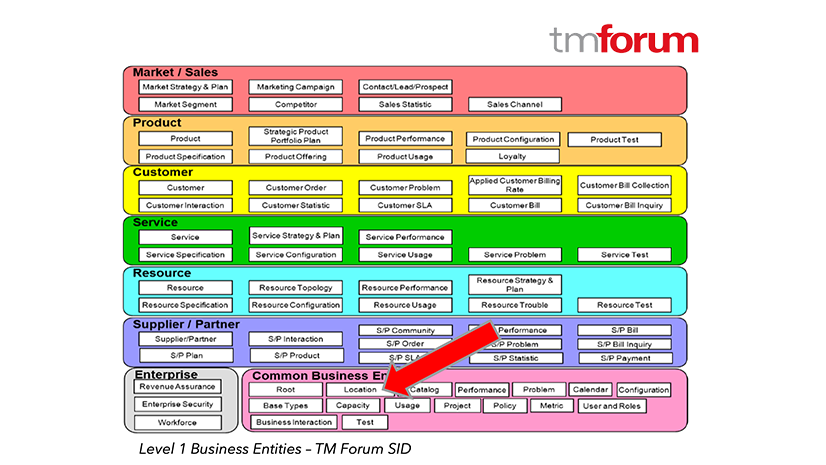
ArcGIS, which is a comprehensive geospatial system, isn’t your grandparent’s GIS. GIS has evolved from a mapping and engineering tool used solely by OSP engineers, into a foundational technology for digital twins and advanced 3D analytics used by the entire organization. It is exciting to see this next phase of GIS technology powering digital twins for not only communication service providers, but for organizations like JPL and NASA who are building digital twins of other planets to aid in space exploration. Learn more about ArcGIS and other examples of digital twins in telecommunications by visiting Esri.com/telecom.
About the author