The Spatial Advantage Across the Mining Value Chain
Mining operations are complex, multidisciplinary, and increasingly shaped by data-intensive methodologies. Success depends on more than just geology—it requires seamless coordination of activities across exploration, development, operations, logistics, and closure. The common thread uniting each phase of the mining lifecycle is location.
Esri Geographic Information System (GIS) technology empowers mining organizations spatial intelligence necessary to drive informed, strategic decisions, enhancing operational efficiency, risk mitigation, and long-term sustainability. across the entire value chain. From discovering high-potential ore bodies to executing post-closure reclamation, Esri ArcGIS solutions provide the tools to connect people, data, and processes in powerful new ways.
Here’s how ArcGIS delivers measurable value across the mining value chain—from pit to port.
Exploration: Finding Value in the Unknown

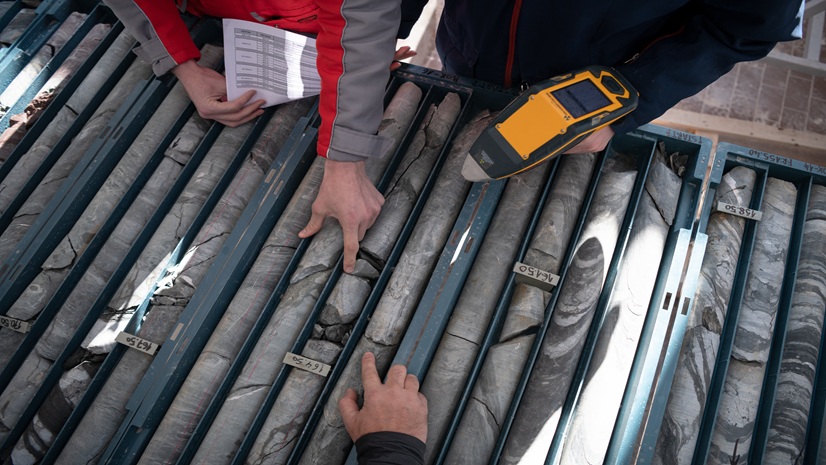
Exploration geologists often manage massive volumes of geoscientific data, ranging from satellite imagery and geochemical assays to airborne geophysics and historic drillhole records, all inherently spatial. ArcGIS Pro and ArcGIS Image Analyst for ArcGIS Pro enable exploration teams to analyze, overlay, and visualize these datasets in immersive 2D and 3D analytical environments.
ArcGIS Benefits in Exploration:
- Integrate multisource geospatial data like imagery, geophysics, and geochemical anomalies to identify prospective targets
- Leverage ArcGIS GeoAnalytics and ArcGIS Spatial Analyst to prioritize prospective exploration zones through advanced spatial modeling
- Deliver stakeholder-ready, interactive web maps and dashboards for informed decision-making
- Streamline tenure and land access management using ArcGIS Field Maps and ArcGIS Survey123
By centralizing exploration data in a spatially aware platform, ArcGIS facilitates more agile targeting and reduces the time between discovery and development.
Mine Operations: Keeping Everything on Track
From pit design to environmental compliance, mining operations teams require continuous access to current, high-fidelity spatial data. ArcGIS Enterprise or ArcGIS Online provide the spatial framework that serves as the central geospatial hub, seamlessly connecting field data, sensors, and business systems.

ArcGIS Benefits in Operations:
- Visualize and model 3D mine infrastructure using ArcGIS Pro and ArcGIS 3D Analyst
- Monitor slope stability, tailings, and ground deformation with ArcGIS Velocity and ArcGIS Image Analyst
- Track mobile assets, equipment and personnel in real time with ArcGIS GeoEvent Server
- Manage environmental KPIs—air quality, vegetation health, water management—through custom dashboards built in ArcGIS Experience Builder and customized with ArcGIS API for Python
ArcGIS acts as a “single source of truth,” to establish a unified operational picture that enabling mine planners, engineers, and environmental teams to collaborate using a consistent spatial context.
Logistics: Optimizing Material Flow
Transporting raw materials from extraction sites to processing facilities or ports involves intricate coordination. ArcGIS introduces end-to-end visibility into the mining logistics chain, allowing organizations to identify inefficiencies, reduce costs, and optimize throughput, helping reduce bottlenecks and improve efficiency.

ArcGIS Benefits in Logistics:
- Model and optimize haulage networks and routing with ArcGIS Network Analyst
- Track trucks, railcars, and shipments in real-time through ArcGIS dashboards
- Conduct traffic and congestion analysis and reduce idle time on-site
- Integrate GIS with ERP and logistics platforms for better decision-making
By visualizing transportation performance in context, operations teams can improve fuel efficiency, asset utilization, and delivery timelines.
Closure & Reclamation: Mapping a Sustainable Future
As mines transition toward closure, maintaining transparency and meeting regulatory expectations becomes paramount. ArcGIS plays a key role in long-term monitoring and environmental compliance. With tools like ArcGIS Dashboards and ArcGIS StoryMaps, organizations can communicate progress to regulators and communities in transparent, engaging ways.

ArcGIS Benefits in Closure and Reclamation:
- Monitor revegetation efforts, terrain recontouring, and hydrological changes with high-resolution, time-enabled datasets
- Leverage historical imagery to track long-term change and assess environmental restoration over time
- Collect and report field observations with ArcGIS Field Maps and ArcGIS Survey123
- Create web apps to share closure updates with internal and external stakeholders with ArcGIS for Excel and ArcGIS for Teams
GIS ensures the closure process is not only well-documented but also clearly communicated and data-driven.
Connecting the Entire Value Chain with ArcGIS
Modern mining is interconnected—so is ArcGIS. As a geospatial enterprise system, ArcGIS integrates with critical business platforms including IoT networks, ERP systems, AI models, and remote sensing tools. This interoperability enables location intelligence to permeate every phase of the mining value chain.
Whether managing exploration tenements or optimizing shipment logistics, adopting a geospatial-first strategy with ArcGIS equips mining professionals with the clarity, precision, and agility to lead in a rapidly evolving industry.
From first drillhole to final shipment, location is everything. Esri helps you see the full picture—and act on it.
