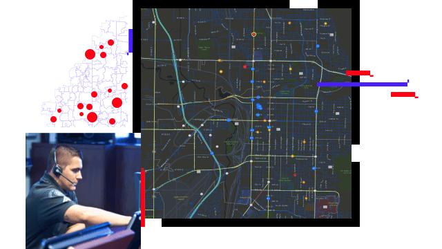
Skip to Content

Performance Monitoring

Support mission-critical decisions with real-time tools

Esri's solution for performance monitoring

Esri offers integrated solutions for emergency communications performance monitoring that support mission-critical decisions with real-time tools. Maintain operational awareness, quickly assess and analyze incidents, and deploy needed resources during your emergency response. Educate, inform, and warn the public with high-quality maps and apps built to scale.

Integrated solutions for performance monitoring

Monitor call volumes and response times

Visualize calls for service and measure response times to better understand agency effectiveness. Empower Public Safety Answering Point (PSAP) and emergency communications personnel with easy-to-configure, location-based dashboards that increase operational understanding.

Modernize with web applications

Equip PSAP personnel and first responders with apps that enable real-time location updates, task management, and data collection. Web apps improve emergency communications, collaboration, and cooperation in the field and command center for real-time performance monitoring.

Integrate systems for a 360º view

Integrate all business systems together into your GIS for a data-driven response and increased operational awareness. Leverage improved location intelligence, resource management, and timely response.

INDUSTRY BLOG

Using ArcGIS Insights for the PSAP

Map PSAP data with projection and location accuracy—turn addresses, coordinates, lines/boundaries, and insights into analytics, using ArcGIS Insights.

Read the blog post

ArcGIS Solutions and products

Previous
Next

Contact sales

Contact us

Outside the United States

Connect with the Esri public safety team

Esri state and local government news


Sign up to receive the latest news, updates, and helpful tips for state and local government professionals.