Real-time dashboards for emergency management response
Maintaining situational awareness is critical to response efforts. Manually collecting and sharing data is slow, and the data is siloed and immediately out-of-date. Using GIS helps provide powerful mapping and analytics capabilities that allow you to see what and where events are happening in real time, brief teams immediately, and make better-informed decisions.
Gain real-time situational awareness
Access information
Make mission-critical choices
Track and manage field teams
Deploy dashboards
Stay ahead of changing conditions
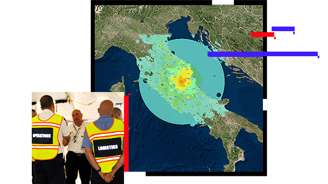
Incidents are constantly evolving, changing the planning assumptions and needs minute by minute. ArcGIS provides the ability to access and ingest real-time information—like weather forecasts as well as current radar, traffic, social media activity, and sensor data from the Internet of Things (IoT)—to support emergency operations.
Analyze potential impacts to anticipate needs
Understanding potential impacts and having the ability to anticipate future needs is at the heart of emergency management. ArcGIS helps you identify where and when to act, using situational awareness dashboards equipped with real-time data analytics that help assess populations, demographics, and infrastructure at risk.
Collect field data and monitor progress
Enabling field teams to share their location and collect data in real time is critical to ensuring they are focused on the right objectives and are out of harm's way. ArcGIS enables organizations to monitor and analyze team members' location, access the data collected from the field, and document what is happening on the ground.
Configure flexible-situation dashboards
Dashboards help you make informed decisions, visualize trends, and monitor status in real time. Using ArcGIS, tailored dashboards provide visual displays that present data in an easy-to-read format on a single screen, facilitating better situational awareness. With multiple structure and design options, configuration is streamlined and straightforward.
USER STORY
Enhancing emergency operations with dashboards
The Town of Chapel Hill, North Carolina, builds a set of informational dashboards to streamline operations at the Emergency Operations Center (EOC).
Read the user study
ESRI BLOG
Keeping the Rose Parade on track
Real-time GIS utilizes sensors on parade floats, handheld devices given to personnel, and social media feeds to enhance situational awareness.
Read the story
ESRI BLOG
Real-time GIS keeps city safe for NCAA Final Four
The Southwest Texas Fusion Center uses real-time information to track officers during the National Collegiate Athletic Association (NCAA) Final Four.
Read the story
USER STORY
Enhancing situational awareness for response
The City of Raleigh renews its focus on situational awareness to strengthen emergency response and recovery.
Read the story
Blog
Chicago manages marathon with real-time awareness
Chicago's Office of Emergency Management and Communications (OEMC) coordinates planning and management using GIS for shared situational awareness.
Read the story
ESRI BLOG
Complex security demands real-time GIS
GIS ensures coverage and the ability to respond quickly over a complex and expansive geography for the Virginia Gold Cup steeplechase horse race.
Read the story
Products for situational awareness
Explore ArcGIS products that enhance situational awareness in emergency and disaster management.