Our community
Find out how your peers are using Esri technology to achieve their goals.


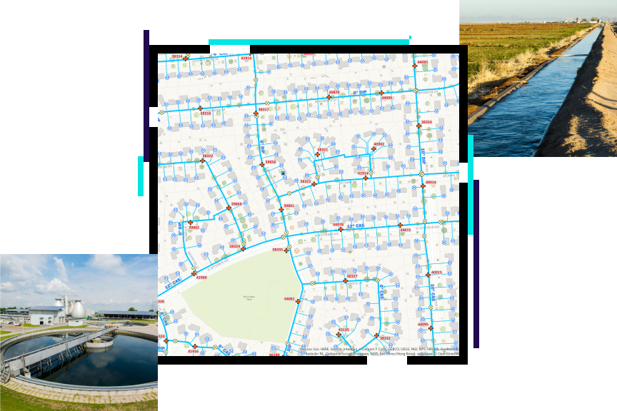
GIS for water, wastewater, and stormwater utilities
Drive success with location intelligence
Utilities’ core function is the timely, orderly movement of water flows, wastewater, and stormwater. This report, created with Bluefield Research, discusses how GIS is the foundation for digital water transformation. GIS facilitates integration, coordination, and analysis of disparate hardware and software, workers and processes, and departments and datasets across space and time.
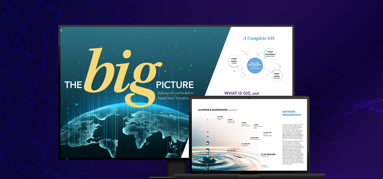
ArcGIS contains all the elements that staff need to meet utility challenges, not just make conventional maps faster. It maintains key information, analyzing and distributing it to everyone that needs business intelligence through a system of record, system of engagement, and system of insight.
Read the ebook Enabling the Intelligent Water System to explore what's possible.
Using location intelligence, utilities discover patterns and trends that simple reporting cannot detect. ArcGIS is a complete location intelligence system, providing easy-to-use analytics and solutions that support daily workflows and challenges.
Network models enable advanced data management tools that improve data quality and support analytics to detect patterns and reveal trends for data-driven decision-making.
Improve efficiency and provide information when it's needed the most. Maps and apps connect staff, enabling coordination and data sharing across your organization.
Devour underutilized data with world-class analytics. ArcGIS delivers capabilities such as spatial analysis, machine learning, big data analytics, and image processing.
ArcGIS interconnects information, systems, models, and behaviors with spatial context, creating holistic digital representations of environments, assets, networks, and cities.
Discover geospatial solutions for infrastructure’s biggest challenges at Esri’s Infrastructure Management and GIS (IMGIS) Conference.
ArcGIS models, connects, and enhances relationships between the built, social, and natural environments, offering advanced visualizations and analytics throughout the entire infrastructure life cycle. Explore the latest geospatial tools and management strategies for long-term success.

Find out how your peers are using Esri technology to achieve their goals.