Each month, the American Public Works Association (APWA) celebrates a new technical area each month. They call it Focus On Public Works (#FocusOnPW for social media). The technical area for June is Emergency Management (#APWAEmergencyMgmt for social media). In support of this effort, I thought it would be a good idea to share some Esri emergency management resources that the APWA and Public Works community may not be aware of.
Emergency Management is one of the disciplines that Esri has been supporting for decades across the globe. Focusing efforts to mitigate the impacts and protect against the complex threats and hazards in today’s modern world requires a deeper understanding of the social, economic, and environmental systems around us. Emergency managers use geographic information system (GIS) technology with data-driven insights to better prepare and help their communities respond and recover from significant events.
GIS supports Emergency Management in each of these five focus areas:
Here are two recent emergency management GIS success stories:
How Visualizing Ice Storm Damage Aided Salem’s Emergency Response
City of Salem, Oregon, staff used a map-based emergency management approach to collect and distribute information for prioritizing ice storm response measures. Facing unexpected and widespread ice storm damages, city public works department deploys smart maps and dashboards. Recovery teams identify tree canopy loss using before-and-after imagery, GIS, and AI machine learning. GIS tools support collaboration across departments and documentation for FEMA reimbursement.
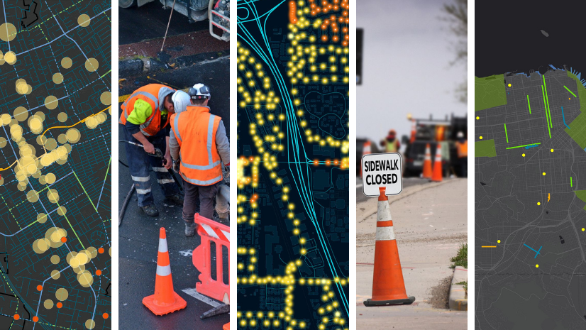
Machine Learning Aids Geospatial Assessment for Disaster Response
Esri partner Dewberry performs geospatial damage assessments for government clients following natural disasters. Advancements in the field of machine learning (ML) are playing an increasingly important role in performing damage assessments because these capabilities are also being used for proactive disaster response.
As part of Esri’s ArcGIS Solutions program, seventeen Emergency Management solutions are included in this collection of over 140 free, configurable, supported, open source maps and apps. These include solutions like flood impact analysis, damage assessment, emergency management operations, road closures, debris management, warming and cooling centers, and a shelter locator.
This last resource is our Disaster Response Program (DRP). The DRP assists organizations responding to disasters or crises worldwide as part of our corporate citizenship. We support response efforts with GIS technology and disaster response expertise when an organization’s capacity is exceeded.
When you need help quickly, Esri can provide data, software, configurable applications, and technical support for your emergency GIS operations. We’re here to ensure you get the help you need to understand the situation, make better decisions, and respond more effectively during a crisis.
Whether the emergency you are managing is natural or man-made, GIS is a powerful tool to support your efforts. Please be sure to take advantage of these resources to support all phases of emergency management:
- Prevention
- Mitigation
- Preparedness
- Response
- Recovery
The stories that appear on our industry webpages, in our industry digital and print newsletters, and in our other industry-focused content are contributed by Esri software users, partners, and others. These stories are meant to help you raise the profile of GIS both inside and outside your organization, showcase innovative approaches to solving challenges with GIS, and above all inspire others to replicate your success. If you have a story to tell, we welcome you to submit your recent success with us at go.esri.com/sharestory.